The National Geologic Map Database is migrating to a new infrastructure. We apologize for any service disruptions during this process.
|
|---|


- Usage in publication:
-
- Blanding Formation
- Modifications:
-
- Named
- Dominant lithology:
-
- Dolomite
- AAPG geologic province:
-
- Wisconsin arch
Summary:
Pg. 35-36. Blanding Formation. At type section, consists of brownish-gray dolomite; thickness 16 m. Overlies Tete des Morts Formation in the north and Mosalem Formation in the south. Conformably underlies Sweeney Formation. Age is Early Silurian.
Type section: Royal Princess Section in Mississippi River Bluffs, Jo Daviess Co., IL. Named from village of Blanding, 4.8 km south of type section, in Jo Daviess Co., northwestern IL.
Source: US geologic names lexicon (USGS Bull. 1520, p. 31-32).
- Usage in publication:
-
- Blanding Formation
- Modifications:
-
- Overview
- AAPG geologic province:
-
- Iowa shelf
- Wisconsin arch
Summary:
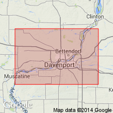
Blanding marks the base of the Silurian section in the study area, which includes parts of Scott Co., IA, and Henry, Whiteside, and Rock Island Cos., IL. Consists predominantly of dolomite and is characterized by an abundance of chert in nodules and beds. It is the most chert-rich Silurian formation in the region. Unit is argillaceous near the base; argillaceous stylolitic surfaces are common. Ranges in thickness between 20 and 30 ft in the Quad Cities area, but thickens greatly northward. Stratigraphic section of eastern IA (fig. 1) from Witzke (1992) shows Blanding divided into a lower Dyas member and an upper Potters Mill member, not discussed in this text. [Units were informally introduced in IL Geol. Survey Guidebook no. 11 and will be formally proposed in a subsequent publication according to the author.] Unconformably overlies shales and shaly carbonates of the Maquoketa Formation (Late Ordovician) in the study area as the older Silurian units of the north are overstepped by the Blanding here. Underlies the Sweeney Member of the Hopkinton Formation. Age is middle Llandoverian.
Source: GNU records (USGS DDS-6; Reston GNULEX).
For more information, please contact Nancy Stamm, Geologic Names Committee Secretary.
Asterisk (*) indicates published by U.S. Geological Survey authors.
"No current usage" (†) implies that a name has been abandoned or has fallen into disuse. Former usage and, if known, replacement name given in parentheses ( ).
Slash (/) indicates name conflicts with nomenclatural guidelines (CSN, 1933; ACSN, 1961, 1970; NACSN, 1983, 2005, 2021). May be explained within brackets ([ ]).