

- Usage in publication:
-
- Blanco Canyon beds
- Modifications:
-
- Original reference
- Dominant lithology:
-
- Clay
- Limestone
- AAPG geologic province:
-
- Permian basin
Summary:
Pg. 190. Blanco Canyon beds. Red clay, white sandy clays, white clays, and a hardened clayey limestone, fronting to east and forming bold escarpment 200 feet high. Constitute Staked Plains, panhandle of Texas. Unconformably overlie Dockum beds. Later than Cretaceous. [Name changed by W.F. Cummins in 1892 (Texas Geol. Survey 3rd Ann. Rpt., p. 134) to Blanco beds.]
[Named from Blanco Canyon, Dickens Co., and Mount Blanco P.O., Crosby Co., panhandle of TX.]
Source: US geologic names lexicon (USGS Bull. 896, p. 211).
- Usage in publication:
-
- Blanco Canyon beds
- Modifications:
-
- Original reference
- AAPG geologic province:
-
- Permian basin
Summary:
Pg. lxxxi, pl. 3. Blanco Canyon beds. White clays, infusorial earth, etc.. containing fossil remains of turtles and large animals. Forms upper portion of Staked Plains, panhandle of Texas. Probably corresponds to upper part of Fayette beds, which it closely resembles in some lithologic features.
[Named from Blanco Canyon, Dickens Co., and Mount Blanco P.O., Crosby Co., panhandle of TX.]
Source: US geologic names lexicon (USGS Bull. 896, p. 211).

- Usage in publication:
-
- Blanco formation*
- Modifications:
-
- Overview
- AAPG geologic province:
-
- Permian basin
Summary:
Blanco formation. Recognized in panhandle of Texas. H.F. Osborn (1907 and 1918) assigned Blanco formation to middle Pliocene. Included in Ogallala formation (Pliocene) on 1937 geologic map of Texas.
Source: US geologic names lexicon (USGS Bull. 896, p. 211).
- Usage in publication:
-
- Blanco beds
- Modifications:
-
- Age modified
- AAPG geologic province:
-
- Permian basin
Summary:
Blanco beds consist mainly of well-bedded light-gray calcareous sands and clays with some fresh-water limestones, tuffs, diatomite, and coarse gravels. Thickness 66 to 74 feet. Unconformably underlain by reddish-brown sands and clays of middle Pliocene and overlain by widespread sheet of surface sands of probably eolian origin. Nebraskan age. Pleistocene age assignment based upon Meade's study of faunas. Blanco beds are believed to be lacustrine deposits laid down in broad shallow basins rather than deposits of a large stream valley as was interpreted by earlier writers.
Source: US geologic names lexicon (USGS Bull. 1200, p. 382-383).
- Usage in publication:
-
- Blanco formation
- Modifications:
-
- Areal extent
- AAPG geologic province:
-
- Permian basin
Summary:
Pg. 7-8. Blanco formation. Unconformably overlies Bridwell formation (new). [Age is middle Pliocene.]
Source: US geologic names lexicon (USGS Bull. 1200, p. 382-383).
- Usage in publication:
-
- Blanco formation
- Modifications:
-
- Overview
- AAPG geologic province:
-
- Anadarko basin
- Central Kansas uplift
- Sedgwick basin
Summary:
Pg. 58-68. Blanco formation. In Kansas, as in other areas of the Great Plains, deposits correlated with Blanco formation commonly are coarse textured in lower part and grade upward into finer textured clastics. Althongh conformable and gradational, these contrasting lithologies merit recognition as named members. In Nebraska, equivalent units are named Holdrege and Fullerton formations; in Kansas, these names are used to designate comparable members of Blanco formation. In central Kansas, Blanco formation was described by Fent (1950) who proposed name Chase Channel formation, containing Holdrege and Fullerton members, for these deposits to Rice County. In this area, formation known primarily from test hole data. South and southeast of Rice County, the Blanco crops out along valleys of Arkansas, Chickaskia, and Ninnescah Rivers in Harper, Kingman, Reno, and Sedgwick Counties. Quantitatively, the Blanco in Kansas has its maximum development in southwestern area where it attains maximum thickness of more than 250 feet. In this area, Smith (1940) described and named Rexroad formation from exposures now classed as Blanco formation. Frye and Hibbard (1941) redescribed these beds as Rexroad member of Ogallala formation. At type locality and west of Channing, Texas, in central Meade County, Kansas, and in Rice County, Kansas, Blanco beds are overlain by Meade formation (in Texas classed as Tule), including Sappa member with Pearlette volcanic ash bed. At all of these localities, unconformable relationships of Blanco to Pliocene Ogallala formation is clear. Pleistocene (Nebraskan).
Source: US geologic names lexicon (USGS Bull. 1200, p. 382-383).
- Usage in publication:
-
- Blanco Formation*
- Modifications:
-
- Paleomagnetics
- AAPG geologic province:
-
- Permian basin
Summary:
A rhyolite volcanic ash bed about 1 ft thick is exposed in a roadcut along TX Hwy 193 in upper part of sequence of lower Pleistocene sedimentary deposits at type locality of Blanco Formation about 37 mi northeast of Lubbock, TX, in Permian basin. This ash has chemical and petrographic characteristics matching the rhyolite air-fall tephra (Pleistocene Guaje Pumice Bed of the Otowi Member of Bandelier Tuff) that immediately underlies the unnamed ash flows of Otowi in the Jemez Mountains of northern NM, in San Juan basin. Composition of glass phase of the ash matches that of Guaje for all major elements (except K and Na). Paleomagnetic measurements indicate that the ash has reverse depositional remanent magnetization. Correlation of the ash bed near Mount Blanco, TX, with the Guaje has implications concerning the duration of the well-known Blancan Land Mammal age.
Source: GNU records (USGS DDS-6; Denver GNULEX).

- Usage in publication:
-
- Blanco Formation
- Modifications:
-
- Mapped 1:250k
- Dominant lithology:
-
- Sand
- Clay
- Limestone
- Gravel
- AAPG geologic province:
-
- Permian basin
Summary:
Blanco Formation. Sand, clay, and limestone, coarser with more gravel toward margin of deposit; weathers glaring white. Sand, fine- to medium-grained quartz, bedded to massive; light greenish-gray, white, gray. Clay, silty, sandy, bentonitic, calcareous in part. Limestone, white, flaggy, thin-bedded. Contains molluscan and vertebrate fossils. Thickness 75 feet; feathers out laterally. Age is Nebraskan [earliest Pleistocene; map legend (on 1993 revised ed.) indicates Pliocene].
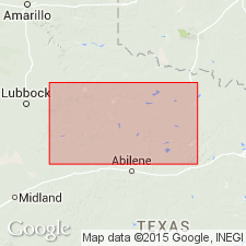
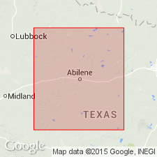
[Mapped in vicinity of Blanco Canyon along White River drainage, south of Mount Blanco, northeastern Crosby Co., TX.]
Source: Publication.
- Usage in publication:
-
- Blanco Formation
- Modifications:
-
- Biostratigraphic dating
- Geochronologic dating
- Paleomagnetics
- AAPG geologic province:
-
- Permian basin
Summary:
Pg. 240+ (fig. 7.1). Blanco Formation. Recognized in Texas. Includes in lower part (descending) Blanco ash and Blanco fauna. Age is considered Blancan to Irvingtonian NALMA; Matuyama chron zone (reversed polarity zone 2r.2r to 1r.2r). Glass shards from Blanco ash yielded a fission-track age of 2.8 +/-0.3 Ma (Boellstorff, 1976), indicating normal polarity zone 2An.1n of Gauss chron zone.
[On p. 241 (fig. 7.1), the Guaje ash bed of Izett and others (1972), about 1.4 to 1.77 Ma, is included in upper part of Blanco Formation. On p. 253 (discussion of Senecan and Rexroadian), the Guaje ash bed overlies the Blanco. On p. 266 (discussion of Blanco fauna in Mount Blanco section, Crosby County, Texas), the Guaje ash bed is included in overlying Blackwater Draw Formation.]
Source: Publication.
For more information, please contact Nancy Stamm, Geologic Names Committee Secretary.
Asterisk (*) indicates published by U.S. Geological Survey authors.
"No current usage" (†) implies that a name has been abandoned or has fallen into disuse. Former usage and, if known, replacement name given in parentheses ( ).
Slash (/) indicates name conflicts with nomenclatural guidelines (CSN, 1933; ACSN, 1961, 1970; NACSN, 1983, 2005, 2021). May be explained within brackets ([ ]).