The National Geologic Map Database is migrating to a new infrastructure. We apologize for any service disruptions during this process.
|
|---|


- Usage in publication:
-
- Blakely sandstone*
- Modifications:
-
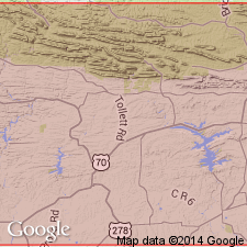
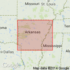
- Areal extent
- Dominant lithology:
-
- Sandstone
- AAPG geologic province:
-
- Ouachita folded belt
Summary:
Pg. 676. Blakely sandstone. Name proposed by A.H. Purdue (in letter) for sandstone recently discovered, which is absent west of Womble but locally developed to thickness of 500 feet east of that town. The discovery of this intercalated sandstone tends to confirm high value of stratigraphic hiatus between Ouachita and Stringtown shales, which hitherto was inferred chiefly on paleontologic evidence. Underlies Stringtown shale [restricted sense] and overlies Ouachita shale. [Age is Early Ordovician.]
Source: US geologic names lexicon (USGS Bull. 896, p. 210-211).
- Usage in publication:
-
- Blakely sandstone*
- Modifications:
-
- Principal reference
- Dominant lithology:
-
- Sandstone
- Shale
- AAPG geologic province:
-
- Ouachita folded belt
Summary:
Pg. 67. Blakely sandstone. Shale, in alternating black and green layers, and hard gray sandstone. The shale constitutes 75 percent of whole formation, but the ridge-forming sandstone is the prominent feature. Thickness 0 to 400 feet. Underlies Womble shale and overlies Mazarn shale. Named from Blakely Mountain, Garland County, southwestern Arkansas, from which it is continuously exposed as far west as Womble, where it thins out and permits Womble shale to rest on Mazarn shale west of that town. In 1909 this sandstone was regarded by A.H. Purdue as upper part of Crystal Mountain sandstone, but it has since been determined by Purdue and writer to occur in middle of "Ouachita shale." [A broader use of "Ouachita shale" than as defined by Purdue in 1909.]
[GNC remark (ca. 1936, US geologic names lexicon, USGS Bull. 896, p. 210-212): Is of Beekmantown and probably Chazy age according to classification of the USGS. Recognized in southwestern Arkansas and southeastern Oklahoma.]
Source: US geologic names lexicon (USGS Bull. 896, p. 210-211).
- Usage in publication:
-
- Blakely sandstone
- Modifications:
-
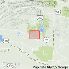
- Areal extent
- AAPG geologic province:
-
- Ouachita folded belt
Summary:
Pg. 23-24. Blakely sandstone. As defined by Miser (1917, USGS Bull. 660), lies stratigraphically above Mazarn shale and below Womble shale. In Oklahoma, Honess (1923, Oklahoma Geol. Survey Bull., no. 32) mentioned two general outcrops of Blakely. One in sec. 16, T. 5 S., R. 23 E., and southwest therefrom, where Honess noticed that the only good exposure is the lower 10 to 15 feet at bottom of cliff on Glover Creek. A series of beds distinct lithologically from Mazarn shale below and Womble siltstone above was noted by present writer [Pitt] near above location. This could be designated as separate formation, but, if it were designated in this way, it is recommended that it not be called Blakely because of findings of current field work in Blakely type area. Other occurrence of Honess' Blakely sandstone is in sec. 25, T. 5 S., R. 23 E., and parts of neighboring sections. Honess noted that "there is some doubt about correlation with the beds to the north" because the "sandstones are not bronze colored." Present writer disagrees with Honess' correlation. Honess' two occurrences of Blakely sandstone are not similar lithologically because the outcrops in the two areas represent two stratigraphic units rather than one stratigraphic unit with several facies. Outcrop that Honess describes as Blakely sandstone consists of one sandstone bed 15 feet thick, which is not at all similar to the 400 feet of interbedded shale and sandstone that Miser describes as Blakely at type locality.
Source: US geologic names lexicon (USGS Bull. 1200, p. 381).
- Usage in publication:
-
- Blakely Sandstone*
- Blakely Formation*
- Modifications:
-
- Overview
- AAPG geologic province:
-
- Ouachita folded belt
Summary:
Pg. 19. Blakely Sandstone; Blakely Formation. Black and green shale in alternating layers with hard gray sandstone and some bluish gray limestone. Although the shale may locally make up 50 to 70 percent of the sequence it is the sandstones that stand out. The sandstones are light-gray to blue, medium-grained, well-cemented and in thin to thick beds. Both silica and calcite have been noted as cement. Where the cement is silca the sandstone is quartzite and is quite resistant to weathering. Erratic meta-arkose boulders and pebbles occur in some conglomeratic sandstones. The shales are sometimes ribboned much like the Mazarn shales. Thickness ranges from a few feet to about 700 feet. The lower contact is considered unconformable by some workers. Fossils (graptolites, conodonts). Age is Middle Ordovician.
Recognized in Ouachita Mountains, west central AR, and in southeastern OK.
Source: Publication.
For more information, please contact Nancy Stamm, Geologic Names Committee Secretary.
Asterisk (*) indicates published by U.S. Geological Survey authors.
"No current usage" (†) implies that a name has been abandoned or has fallen into disuse. Former usage and, if known, replacement name given in parentheses ( ).
Slash (/) indicates name conflicts with nomenclatural guidelines (CSN, 1933; ACSN, 1961, 1970; NACSN, 1983, 2005, 2021). May be explained within brackets ([ ]).