- Usage in publication:
-
- Backwater Creek shale member
- Modifications:
-
- Original reference
- Dominant lithology:
-
- Shale
- AAPG geologic province:
-
- Forest City basin
Summary:
Pl. 1. Backwater [Blackwater] Creek shale member of Fort Scott formation. Gray argillaceous shale; locally red. Thickness 19 to 25 feet. Below Higginsville limestone and above Houx limestone. Name appears as Backwater Creek. [Age is Middle Pennsylvanian (Desmoinesian).]
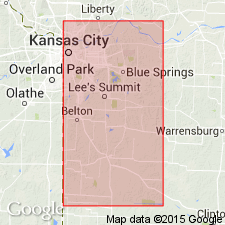
[Type locality and origin of name not given. First noted in Jackson and Cass Cos., northwestern MO.]
Source: US geologic names lexicon (USGS Bull. 1200, p. 378).

- Usage in publication:
-
- Blackwater Creek shale
- Modifications:
-
- Revised
- AAPG geologic province:
-
- Forest City basin
- Ozark uplift
Summary:
Pg. 6, fig. 1. Blackwater Creek shale in Little Osage member of Fort Scott formation. Shale at top of Little Osage member of Fort Scott formation. A channel-type sandstone, herein named Flint Hill, occurs above the Blackwater Creek from northern Boone County into southeastern Grundy County, Missouri. [Age is Middle Pennsylvanian (Desmoinesian).]
Source: US geologic names lexicon (USGS Bull. 1200, p. 378).

- Usage in publication:
-
- Blackwater Creek†
- Modifications:
-
- Abandoned
Summary:
Pg. 33. †Blackwater Creek shale in Little Osage Member of Fort Scott Formation; †Blackwater Creek shale in Fort Scott Formation. Abandoned. Although several authors used the term, it never gained formal acceptance. Now referred to as upper shale of Little Osage Shale of Fort Scott subgroup [informal] of Marmaton Group. [On p. 174, under Little Osage entry, author states Blackwater Creek Shale Member is resurrected in this report. Blackwater Creek is resurrected in Thompson and Gentile (2004).] Ravn and others (1984) called this interval unnamed shale member of Stephens Forest Formation in Iowa.
["Subgroup" not recognized as a formal stratigraphic rank term (CSN, 1933; ACSN, 1961, 1970; NACSN, 1983, 2005, 2021). Considered informal and should not be capitalized.]
Source: Publication.

- Usage in publication:
-
- Blackwater Creek Shale Member
- Modifications:
-
- Reinstated
- Principal reference
- Revised
- Dominant lithology:
-
- Shale
- AAPG geologic province:
-
- Cherokee basin
- Forest City basin
- Illinois basin
- Lincoln anticline
- Ozark uplift
Summary:
Pg. B170-B178, Appendix B. Blackwater Creek Shale Member of Little Osage Formation of Fort Scott subgroup [informal] of Marmaton Group. Consists of a lower gray to dark-gray, almost black shale overlain by a lighter grayish-green, more clayey shale. Thickness 15 to 20+ feet. Includes Flint Hill sandstone facies. Lies above Houx Limestone Member of Little Osage Formation and below Higginsville Limestone. Age is Middle Pennsylvanian (Desmoinesian).
Type section: in east cutbank of tributary to Rocky Fork Creek on east side of northbound lane of U.S. Highway 63 at western edge of Finger Lakes State Park, 0.25 mi north of a crossroad [Peabody Road], 4.5 mi northwest of Browns, in SW/4 SW/4 NW/4 NE/4 sec. 36, T. 50 N., R. 13 W., [approx. Lat. 39 deg. 04 min. 49 sec. N., Long. 92 deg. 19 min. 47 sec. W.], Browns 7.5-min quadrangle, Boone Co., central MO.
Reference sections: (1) can be seen in an almost continuous series of highwall exposures in secs. 5 through 20, T. 56 N., R. 14 W., Bevier South and Macon 7.5-min quadrangles, Macon Co., central MO; (2) entrance road to Hilty Quarries, Inc., on north side of Henry Co. Route H, 0.75 mi west of junction of H with Co. Route K, 3 mi west of Montrose, in NW/4 SE/4 NW/4 sec. 16, T. 40 N., R. 28 W., Johnstown 7.5-min quadrangle, Henry Co., central MO.
["Subgroup" not recognized as a formal stratigraphic rank term (CSN, 1933; ACSN, 1961, 1970; NACSN, 1983, 2005, 2021). Fort Scott subgroup considered informal and should not be capitalized.]
[Additional locality information from USGS historical topographic map collection TopoView, accessed on February 10, 2021.]
Source: Publication.
For more information, please contact Nancy Stamm, Geologic Names Committee Secretary.
Asterisk (*) indicates published by U.S. Geological Survey authors.
"No current usage" (†) implies that a name has been abandoned or has fallen into disuse. Former usage and, if known, replacement name given in parentheses ( ).
Slash (/) indicates name conflicts with nomenclatural guidelines (CSN, 1933; ACSN, 1961, 1970; NACSN, 1983, 2005, 2021). May be explained within brackets ([ ]).

