The National Geologic Map Database is migrating to a new infrastructure. We apologize for any service disruptions during this process.
|
|---|


- Usage in publication:
-
- Blackstone Group*
- Modifications:
-
- Areal extent
- Age modified
- AAPG geologic province:
-
- New England province
Summary:
Blackstone Group extended into eastern MA and assigned a definite Proterozoic Z age because units of the group are intruded by Proterozoic Z plutonic rocks and are more metamorphosed than nearby Cambrian Hoppin Formation.
Source: GNU records (USGS DDS-6; Reston GNULEX).

- Usage in publication:
-
- Blackstone Group*
- Modifications:
-
- Overview
- AAPG geologic province:
-
- New England province
Summary:
Used as Blackstone Group of Proterozoic Z age. Mapped undivided as quartzite, schist, phyllite, marble, and metavolcanic rocks. Separable units include a mica schist and phyllite unit (which includes Mussey Brook Schist and Sneech Pond Schist), the Quinnville Quartzite, and a greenstone and amphibolite unit (which includes Hunting Hill Greenstone).
Source: GNU records (USGS DDS-6; Reston GNULEX).
- Usage in publication:
-
- Blackstone Group
- Modifications:
-
- Overview
- AAPG geologic province:
-
- New England province
Summary:
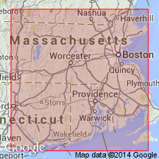
Blackstone Group overlies Harmony Complex in the Esmond-Dedham terrane of western RI. Nomenclature of this report follows that of Quinn (1971) who subdivided the Blackstone into Hunting Hill Greenstone, Mussey Brook Schist, Sneech Pond Schist, and Quinnville Formation. Hunting Hill is cut by the Esmond Granite/Plutonic Suite which has been dated at 621+/-8 Ma. Relative ages of the Blackstone units have not been determined. Entire group considered Late Proterozoic.
Source: GNU records (USGS DDS-6; Reston GNULEX).
- Usage in publication:
-
- Blackstone Group*
- Modifications:
-
- Overview
- AAPG geologic province:
-
- New England province
Summary:
Blackstone Group (Blackstone Series of Woodworth, in Shaler and others, 1899) was defined by Quinn and others (1948) to include Mussey Brook Schist, Quinnville Quartzite, Sneech Pond Schist, and Hunting Hill Greenstone. On State bedrock map (Zen and others, 1983), schist units are combined into one unit of mica schist and phyllite based on mapping by Drier and Mosher (1981, NEIGC Guidebook) who saw no basis for distinguishing them; it is possible that Quinnville is just a lens separating the same schist, or that schist were repeated by folding. Mica schist and phyllite unit and Quinnville Quartzite are shown only in type areas; elsewhere, units cannot be distinguished separately, so they are mapped undivided. Blackstone also includes layers, dikes, and sills of greenstone or amphibolite believed to be equivalent to Hunting Hill Greenstone, which is also mapped only in its type area. Undivided Blackstone occurs along Blackstone River from northern RI into MA in towns of Blackstone, Milford, and Uxbridge, and in the Franklin and Medway areas. A belt of Blackstone also extends south from Nipmuck Pond, southwest of Mendon. Lower metasedimentary part of Blackstone correlates with Westboro and Plainfield Formations. Blackstone-Westboro contact is arbitrarily based on proximity to respective type areas. Report includes geologic maps and correlation charts. [Chapters A-J in U.S. Geological Survey Professional Paper 1366 are intended as explanations and (or) revisions to 1:250,000-scale MA State bedrock geologic map of Zen and others (1983).]
Source: GNU records (USGS DDS-6; Reston GNULEX).
For more information, please contact Nancy Stamm, Geologic Names Committee Secretary.
Asterisk (*) indicates published by U.S. Geological Survey authors.
"No current usage" (†) implies that a name has been abandoned or has fallen into disuse. Former usage and, if known, replacement name given in parentheses ( ).
Slash (/) indicates name conflicts with nomenclatural guidelines (CSN, 1933; ACSN, 1961, 1970; NACSN, 1983, 2005, 2021). May be explained within brackets ([ ]).