The National Geologic Map Database is migrating to a new infrastructure. We apologize for any service disruptions during this process.
|
|---|


- Usage in publication:
-
- Blackhawk formation*
- Modifications:
-
- Original reference
- Dominant lithology:
-
- Sandstone
- Shale
- Coal
- AAPG geologic province:
-
- Paradox basin
Summary:
Pg. 443. Blackhawk formation of Mesaverde group. A succession of sandstone, shale, and coal beds of kinds common in Mesaverde group. Thickness 750 to 900 feet in Wasatch Plateau and 450 feet in Book Cliffs, central eastern Utah. Base is normally drawn at base of lowest coal bed. Is middle formation of Mesaverde group. Underlies (unconformably?) Price River formation and conformably overlies Star Point sandstone. Age is Late Cretaceous.
Named from prominent exposures near Blackhawk, a mining community on eastern front of Wasatch Plateau, central eastern UT.
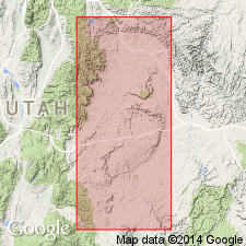
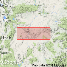
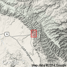
[Blackhawk Mine at Lat. 39 deg. 28 min. 09 sec. N., Long. 111 deg. 01 min. 06 sec. W., Hiawatha 7.5-min quadrangle, northernmost Emery Co., UT.]
Source: US geologic names lexicon (USGS Bull. 896, p. 202).
- Usage in publication:
-
- Blackhawk formation
- Modifications:
-
- Revised
- AAPG geologic province:
-
- Paradox basin
- Uinta basin
Summary:
Base of formation revised to include sandstone formerly assigned to the Star Point sandstone called Spring Canyon tongue, upper unit of Star Point. Spring Canyon, reassigned to Blackhawk as its basal member, revised to include not only the sandstone of the original unit but also the overlying Spring Canyon coal group. The remainder of the Blackhawk is divided in Carbon Co, Uinta basin, and Emery and Grand Cos, Paradox basin, UT into the (ascending): Aberdeen (revised from Aberdeen sandstone member to Aberdeen member); Kenilworth (new); Sunnyside (new); Grassy (new); and Desert (new) members. Division of Blackhawk possible where the littoral marine sandstones are developed. Eastward as these tongues disappear, the name Mancos shale applied. Blackhawk underlies Castlegate member of Price River formation. Cross section. Late Cretaceous age.
Source: GNU records (USGS DDS-6; Denver GNULEX).
- Usage in publication:
-
- Blackhawk Formation*
- Modifications:
-
- Overview
- AAPG geologic province:
-
- Uinta basin
Summary:
Is the basal formation of the Mesaverde Group in the Sunnyside district, Carbon Co, UT in the Uinta basin. Was deposited along the west margin of the Western Interior Cretaceous sea during the southeastward withdrawal of the sea. Overlies and intertongues with Mancos Shale. Underlies Castlegate Sandstone of Mesaverde Group. Divisible into (ascending): Aberdeen Member, Kenilworth Member, lower mudstone member, Sunnyside Member, and upper mudstone member. Principal reference section designated for the Kenilworth and Sunnyside Members. Abundant trace fossils (trails and burrows) described. Nomenclature chart; geologic map. Depositional environments described. Late Cretaceous age.
Source: GNU records (USGS DDS-6; Denver GNULEX).

- Usage in publication:
-
- Blackhawk Formation*
- Modifications:
-
- Age modified
- AAPG geologic province:
-
- Paradox basin
- Uinta basin
Summary:
Is of early to middle Campanian age in the Paradox basin and on the Wasatch uplift. Palynomorphs identified in NW1/4 sec 2 and NW1/4 sec 1, T13S, R9E, Carbon Co., Uinta basin. Intertongues with the underlying Star Point Sandstone between the East Wasatch Plateau and Price Canyon; intertongues with the underlying Blue Gate Member in the Sunnyside area. Unconformably underlies Castlegate Sandstone between the East Wasatch Plateau and Sunnyside. East of Sunnyside is conformable with the Castlegate.
Source: GNU records (USGS DDS-6; Denver GNULEX).
For more information, please contact Nancy Stamm, Geologic Names Committee Secretary.
Asterisk (*) indicates published by U.S. Geological Survey authors.
"No current usage" (†) implies that a name has been abandoned or has fallen into disuse. Former usage and, if known, replacement name given in parentheses ( ).
Slash (/) indicates name conflicts with nomenclatural guidelines (CSN, 1933; ACSN, 1961, 1970; NACSN, 1983, 2005, 2021). May be explained within brackets ([ ]).