- Usage in publication:
-
- Blackgum Formation
- Modifications:
-
- Named
- Dominant lithology:
-
- Dolomite
- Limestone
- AAPG geologic province:
-
- Chautauqua platform
Summary:
Name proposed for strata formerly referred to basal part of "St. Clair Formation" of northeastern Oklahoma (Huffman, 1958, Oklahoma Geol. Survey Bull., no. 77) [not synopsized here]. Comprises sequence of Lower Silurian carbonate strata which overlie Sylvan Shale and underlie Tenkiller Formation (new). Contains a tan dolomite member and upper limestone member. At base is locally developed oolitic bed herein named Pettit Oolite Member. Thickness 13 feet at type locality; 10 to 15 feet in coreholes. Age is Early Silurian.
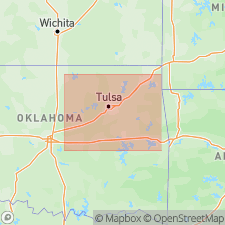
Type locality: at Blackgum Landing on southeast shore of Lake Tenkiller, SW/4 SE/4 sec. 32, T. 14 N., R. 22 E., Cherokee Co., northeastern OK.
Source: US geologic names lexicon (USGS Bull. 1350, p. 74).
For more information, please contact Nancy Stamm, Geologic Names Committee Secretary.
Asterisk (*) indicates published by U.S. Geological Survey authors.
"No current usage" (†) implies that a name has been abandoned or has fallen into disuse. Former usage and, if known, replacement name given in parentheses ( ).
Slash (/) indicates name conflicts with nomenclatural guidelines (CSN, 1933; ACSN, 1961, 1970; NACSN, 1983, 2005, 2021). May be explained within brackets ([ ]).

