The National Geologic Map Database is migrating to a new infrastructure. We apologize for any service disruptions during this process.
|
|---|


- Usage in publication:
-
- Black Prince limestone
- Modifications:
-
- Incidental mention
- AAPG geologic province:
-
- Pedregosa basin
Summary:
Pg. 6. Black Prince limestone. Incidental mention. Limestones of Carboniferous period consisting of Escabrosa, Black Prince, and Naco formations in order named, overlie Martin limestone in Johnson Camp area, Little Dragoon Mountains, Cochise County, Arizona.
Source: US geologic names lexicon (USGS Bull. 1200, p. 371).
- Usage in publication:
-
- Black Prince limestone*
- Modifications:
-
- Principal reference
- Dominant lithology:
-
- Shale
- AAPG geologic province:
-
- Pedregosa basin
Summary:
13-15. Black Prince limestone. Comprises basal shale member and upper limestone member. Shale, 10 to 20 feet thick, is red to maroon or purple with scattered nodules or pebbles of chert and limestone, lenses of chert conglomerate and, locally into beds of limestone. Limestone unit consists of 100 to 140 feet of nearly pure limestone in 1- to 4-foot beds. Limestone is medium- to coarse-grained and light-gray to pink; pink beds most conspicuous in upper part. Thickness: 119 feet in Gunnison Hills; 131 and 155 feet in Little Dragoons; 168 feet in Johnny Lyon Hills. Separated from overlying Horquilla limestone (new) of Naco group by 30 to 65 feet of weak rocks which generally are concealed and form topographic sags. Underlies Escabrosa limestone, contact drawn at base of thin but persistent shale member which contrasts with pure limestone beds above and below. Where shale is missing, it is difficult to separate the Black Prince and Escabrosa.
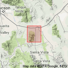
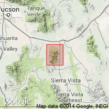
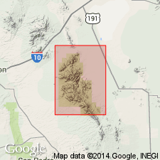
Type section: on west slope of Gunnison Peak 4.5 mi southeast of Black Prince Mine in Johnson mining district at east base of Little Dragoon Mountains, in NE/4 SW/4 sec. 4, T. 16 S., R. 23 E., central Cochise Co., southeastern AZ. Named from Black Prince Mine.
Source: US geologic names lexicon (USGS Bull. 1200, p. 371).
- Usage in publication:
-
- Black Prince limestone
- Modifications:
-
- Age modified
- AAPG geologic province:
-
- Pedregosa basin
Summary:
Assigned an age of Early Pennsylvanian (Morrowan). Mississippian fossils in base of formation are a residual accumulation from erosion of the underlying Escabrosa limestone. Study area in Pedregosa basin.
Source: Modified from GNU records (USGS DDS-6; Denver GNULEX).
- Usage in publication:
-
- Black Prince Limestone Member
- Modifications:
-
- Revised
- Overview
- AAPG geologic province:
-
- Pedregosa basin
Summary:
Reduced in rank and considered a member at top of the newly named Hachita Formation of Escabrosa Group in central Cochise Co, AZ in the Pedregosa basin. Coral fauna is described. Age is uncertain, but appears to be Meramecian (Late Mississippian) on basis of fossils and lithologic correlation with upper part of Hachita Formation at Blue Mountain.
Source: GNU records (USGS DDS-6; Denver GNULEX).

- Usage in publication:
-
- Black Prince limestone*
- Modifications:
-
- Overview
- AAPG geologic province:
-
- Pedregosa basin
Summary:
Resembles underlying Escabrosa limestone but is separately mapped because fossils are "distinctly younger" than those of "Escabrosa". Is separable from Escabrosa by a basal shale that contrasts Black Prince from underlying upper limestones of Escabrosa. Section measured in NE1/4 SW1/4 sec 4, T16S, R23E described. At that locality Black Prince is 119 ft thick and lies between Escabrosa (below) and Horquilla (above) limestones. Ranges in thickness in area between 120-170 ft. Coral, bryozoan, brachiopod, pelecypod, and gastropod fauna (listed) collected from the lower 60 ft. Assigned Late Mississippian or Early Pennsylvanian age. Geologic map. Mapped in 3 major areas --northeast of Palomas Wash, in northwest part of quad., and in Gunnison Hills in southeast corner of quad., Cochise Co, AZ in the Pedregosa basin. Cross sections. Stratigraphic table.
Source: GNU records (USGS DDS-6; Denver GNULEX).
- Usage in publication:
-
- Black Prince Limestone*
- Modifications:
-
- Overview
- Areal extent
- AAPG geologic province:
-
- Pedregosa basin
- Basin-and-Range province
Summary:
Used in Whetstone Mountains, AZ, Pedregosa basin and Basin-and-Range province. Measured section in NW1/4 sec 13, T18S, R18E, Pima Co, 278 ft thick and in NW1/4 sec 23, T19S, R19E, Cochise Co, 148 ft thick, described. Of Late Mississippian or Early Pennsylvanian? age.
Source: GNU records (USGS DDS-6; Denver GNULEX).
- Usage in publication:
-
- Black Prince Limestone
- Modifications:
-
- Age modified
- Areal extent
- AAPG geologic province:
-
- Pedregosa basin
- Basin-and-Range province
Summary:
Shown on figures as of Morrowan age and extending across much of southeastern and south-central AZ in the Pedregosa basin and Basin-and-Range province. Is of Pennsylvanian (Morrowan) age.
Source: GNU records (USGS DDS-6; Denver GNULEX).
- Usage in publication:
-
- Black Prince Limestone*
- Modifications:
-
- Age modified
- AAPG geologic province:
-
- Pedregosa basin
- Basin-and-Range province
Summary:
Age changed from Late Mississippian or Early Pennsylvanian? to Early Pennsylvanian in Whetstone Mountains, Cochise and Pima Cos., AZ in the Pedregosa basin and Basin-and-Range province. No evidence given for change.
Source: GNU records (USGS DDS-6; Denver GNULEX).
- Usage in publication:
-
- Black Prince Limestone*
- Modifications:
-
- Mapped 1:24k
- Dominant lithology:
-
- Limestone
- Shale
- AAPG geologic province:
-
- Pedregosa basin
Summary:
Black Prince Limestone [interpreted here to be excluded from Naco Group; Description of Map Units unclear]. Mapped and described by Cooper and Silver (1964, USGS Prof. Paper 416). Recognized only in northwest corner of map area in foothills of Little Dragoon Mountains. Light-pinkish-gray, cherty, fossiliferous limestone about 30 m thick, and a basal deep-maroon shale 5 m thick that includes a 15-cm-thick bed of chert-chip sedimentary breccia (possibly correlative with chert-chip bed in lower member of Horquilla Limestone). Age is Carboniferous (Mississippian and Pennsylvanian).
Source: Publication.
For more information, please contact Nancy Stamm, Geologic Names Committee Secretary.
Asterisk (*) indicates published by U.S. Geological Survey authors.
"No current usage" (†) implies that a name has been abandoned or has fallen into disuse. Former usage and, if known, replacement name given in parentheses ( ).
Slash (/) indicates name conflicts with nomenclatural guidelines (CSN, 1933; ACSN, 1961, 1970; NACSN, 1983, 2005, 2021). May be explained within brackets ([ ]).