

- Usage in publication:
-
- Black Mountain Tuff*
- Modifications:
-
- Named
- Dominant lithology:
-
- Tuff
- Rhyolite
- AAPG geologic province:
-
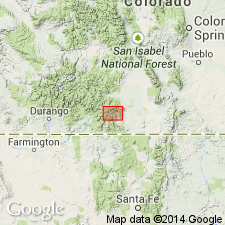
- San Luis basin
Summary:
Named as formation of Treasure Mountain Group (rank raised) for topographic feature on north side of Conejos River, Conejos Co, CO (San Luis basin) following informal nomenclature of Dungan and others (1989, New Mexico Bur. Mines and Min. Res. Mem. 46). Type locality designated as cliff exposures above Conejos River canyon along southwest side of Black Mountain. Previously referred to as upper unit of lower tuff of Treasure Mountain Tuff (Lipman, 1975, USGS Prof. Paper 852) and Black Mountain unit of Treasure Mountain Tuff (Dungan and others, 1989). Unit is densely welded low-silica rhyolite, widely characterized by lithophysal cavities and large collapsed pumice lenses; commonly contains both hornblende andesitic and dacitic pumice in an upper vitrophyre zone. Though exposure is discontinuous because of cover by younger units, Black Mountain is as widespread and voluminous as some other units of Treasure Mountain. Unit was erupted from within Platoro caldera complex of San Juan volcanic field as indicated by areal distribution, thickness changes, and distributions of proximal vs. distal facies. Tuff was preferentially deposited in broad valleys between Conejos volcanic edifices. Total volume is estimated at 100 cu km (table 1). Overlies lower rhyolite tuff of Treasure Mountain; underlies La Jara Canyon Tuff (rank raised) of Treasure Mountain. Ar-Ar age is 29.5(?) Ma (Oligocene) (table 1).
Source: GNU records (USGS DDS-6; Denver GNULEX).
For more information, please contact Nancy Stamm, Geologic Names Committee Secretary.
Asterisk (*) indicates published by U.S. Geological Survey authors.
"No current usage" (†) implies that a name has been abandoned or has fallen into disuse. Former usage and, if known, replacement name given in parentheses ( ).
Slash (/) indicates name conflicts with nomenclatural guidelines (CSN, 1933; ACSN, 1961, 1970; NACSN, 1983, 2005, 2021). May be explained within brackets ([ ]).