- Usage in publication:
-
- Black Mesa Gravel*
- Modifications:
-
- Named
- Dominant lithology:
-
- Gravel
- Sand
- AAPG geologic province:
-
- Snake River basin
Summary:
Pg. 1199 (fig. 1), 1212, pI. 1. Black Mesa Gravel of Idaho Group. Beds of Bruneau and Glenns Ferry Formations (both new) south of Snake River near Glenns Ferry are beveled by erosion surface that terminates 550 feet above river level. This surface is veneered with about 25 feet of sand and gravel, herein named Black Mesa Gravel. Gravel derived locally from underlying Bruneau Formation or from reworked Tuana Gravel (new); sand dominates unit southward beyond margins of Bruneau, and is derived from underlying reworked Glenns Ferry Formation. Capped by hard caliche several feet thick; forms badlands and tablelands topography. Underlies Madson Basalt of Snake River Group. Black Mesa Gravel is older than present Snake River Canyon and is regarded as middle Pleistocene. Report includes generalized geologic map, cross section, stratigraphic chart.
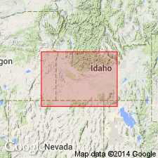
Named from Black Mesa, an upland area 5 mi southeast of Glenns Ferry, Owyhee Co., southwestern ID, where gravel is typically exposed. Remnants of unit extend 10 mi southward and 15 mi westward of type.
Source: US geologic names lexicon (USGS Bull. 1350, p. 75); supplemental information from GNU records (USGS DDS-6; Denver GNULEX).
For more information, please contact Nancy Stamm, Geologic Names Committee Secretary.
Asterisk (*) indicates published by U.S. Geological Survey authors.
"No current usage" (†) implies that a name has been abandoned or has fallen into disuse. Former usage and, if known, replacement name given in parentheses ( ).
Slash (/) indicates name conflicts with nomenclatural guidelines (CSN, 1933; ACSN, 1961, 1970; NACSN, 1983, 2005, 2021). May be explained within brackets ([ ]).

