The National Geologic Map Database is migrating to a new infrastructure. We apologize for any service disruptions during this process.
|
|---|


- Usage in publication:
-
- Black Cap limestone*
- Modifications:
-
- Named
- Biostratigraphic dating
- Dominant lithology:
-
- Limestone
- AAPG geologic province:
-
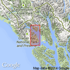
- Alaska Southeastern region
Summary:
Named for exposures on Black Cap Mountain where a thick (but not complete), structurally complex section crops out. Thin-bedded black limestone at base becomes progressively lighter colored and thicker bedded upward. Upper contact has not been recognized. Overlies Rendu Formation. True thickness not known, but dark colored basal part may be about 700 ft thick and light-colored upper part may be about 3,800 ft thick. Contains marine invertebrate fauna; best fossils come from east of Muir Inlet. Edwin Kirk says fossils are of Middle Devonian age.
Source: GNU records (USGS DDS-6; Menlo GNULEX).
For more information, please contact Nancy Stamm, Geologic Names Committee Secretary.
Asterisk (*) indicates published by U.S. Geological Survey authors.
"No current usage" (†) implies that a name has been abandoned or has fallen into disuse. Former usage and, if known, replacement name given in parentheses ( ).
Slash (/) indicates name conflicts with nomenclatural guidelines (CSN, 1933; ACSN, 1961, 1970; NACSN, 1983, 2005, 2021). May be explained within brackets ([ ]).