

- Usage in publication:
-
- Black Box Dolomite
- Modifications:
-
- Named
- Dominant lithology:
-
- Limestone
- Sandstone
- AAPG geologic province:
-
- Paradox basin
Summary:
Name proposed for a distinctive carbonate on the Emery high of central Utah, in the Paradox basin. Also present at Capitol Reef. Type section is a section measured by Gilluly and Reeside (1927) in which they assigned the same rocks to Kaibab Limestone. Renamed because these rocks are not similar to Kaibab of Grand Canyon area. [Designated "Kaibab Limestone" in the measured section reproduced in this report.] Is a 69 to 85.5 feet thick interval conformably above the Coconino Sandstone and unconformably beneath the Moenkopi Formation at type. At type, divided into (ascending): (1) thin-bedded white limestone with gray chert nodules, and sandstone and shale lenses; (2) gray, massive, very limy, micaceous, unevenly granular sandstone that weathers white; and (3) gray to cream, light- to dark-gray weathering limestone with abundant nodules and iron concretions. Section 185 feet thick penetrated in subsurface, in sec. 26, T. 15 S., R. 10 E., where Black Box unconformably overlies Cedar Mesa Sandstone and unconformably underlies "Black Dragon siltstone." Is equivalent to upper part of Fossil Mountain Limestone of Kaibab Group. Fossils (mollusks, brachiopods, corals, sponges) listed [presumably from "Kaibab" of earlier reports or Black Box of this report]. Age is Late Permian. Report includes cross sections.
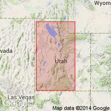
Type section: section measured by Gilluly and Reeside (1927), half a mile (0.8 km) south of head of Black Box Canyon of the San Rafael River, in the San Rafael Swell, Emery Co., UT [From US geologic names lexicon, USGS Bull. 1564 (p. 14)].
Source: Modified from GNU records (USGS DDS-6; Denver GNULEX).
For more information, please contact Nancy Stamm, Geologic Names Committee Secretary.
Asterisk (*) indicates published by U.S. Geological Survey authors.
"No current usage" (†) implies that a name has been abandoned or has fallen into disuse. Former usage and, if known, replacement name given in parentheses ( ).
Slash (/) indicates name conflicts with nomenclatural guidelines (CSN, 1933; ACSN, 1961, 1970; NACSN, 1983, 2005, 2021). May be explained within brackets ([ ]).