

- Usage in publication:
-
- Bivouac formation*
- Modifications:
-
- Original reference
- Dominant lithology:
-
- Conglomerate
- Sandstone
- Siltstone
- Claystone
- Tuff
- AAPG geologic province:
-
- Yellowstone province
Summary:
Pg. 1899, 1907-1911, fig. 1. Bivouac formation. Slightly lithified conglomerate with minor amounts of very soft sandstone, siltstone, claystone, and pumicite, and one welded tuff. Conglomerate is brownish gray, soft, porous, and poorly stratified. Welded rhyolite tuff is most conspicuous feature of formation, and crops out in cliffs on north and east sides of Signal Mountain where it is about 60 feet thick. Tuff is about 700 feet above lowest exposures of formation. Minimum thickness for formation on Signal Mountain is about 1,000 feet. Unconformably overlain and surrounded by several sequences of Pleistocene glacial and interglacial deposits. Unconformably overlies Teewinot formation (new). Age is late Pliocene or Pliocene.
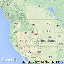
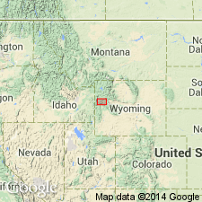
Type section: on Signal Mountain, south of town of Moran and east of Jackson Lake, in secs. 19 and 20, T. 45 N., R. 114 W., Teton Co., northwestern WY. Named from Bivouac Peak, a prominent peak in Teton Range, directly west of type section.
Source: US geologic names lexicon (USGS Bull. 1200, p. 357).
- Usage in publication:
-
- Bivouac Formation†
- Modifications:
-
- Abandoned
- AAPG geologic province:
-
- Yellowstone province
Summary:
Was thought to be a Miocene unit in Yellowstone province, WY. Now known to include four units assigned to (oldest to youngest): unnamed gravel (late Miocene), Conant Creek Tuff (early Pliocene), till of glaciation 1 (Pliocene), and Huckleberry Ridge Tuff (latest Pliocene). Name abandoned.
Source: GNU records (USGS DDS-6; Denver GNULEX).
For more information, please contact Nancy Stamm, Geologic Names Committee Secretary.
Asterisk (*) indicates published by U.S. Geological Survey authors.
"No current usage" (†) implies that a name has been abandoned or has fallen into disuse. Former usage and, if known, replacement name given in parentheses ( ).
Slash (/) indicates name conflicts with nomenclatural guidelines (CSN, 1933; ACSN, 1961, 1970; NACSN, 1983, 2005, 2021). May be explained within brackets ([ ]).