

- Usage in publication:
-
- Bitter Ridge Limestone Member*
- Modifications:
-
- Named
- Dominant lithology:
-
- Limestone
- Sandstone
- AAPG geologic province:
-
- Great Basin province
Summary:
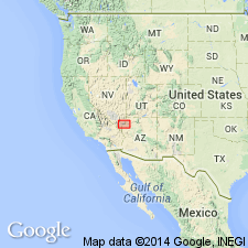
Named as one of four members of Horse Spring Formation for exposures on the hogback of Bitter Ridge, Clark Co, NV in the Great Basin province. Type section on the ridge is at lat 36 deg 18' 30" N, 114 deg 35' 00" W. Distribution map. Present in Clark Co west of Overton Arm and east of Frenchman Mountain. Overlies the Thumb Member (reduced in rank from formation; newly assigned to Horse Spring). Underlies the newly named Lovell Wash Member of Horse Spring. Present distribution in several separated outcrops in NV is north of Lake Mead from Frenchman Mountain east to Bitter Ridge, NV; not as widespread as Rainbow Gardens and Thumb Members. Is 375 m thick at type; ranges between 300-400 m thick in area. Consists of uniform light-brown, yellow, pink; parallel to wavy-bedded, stromatolitic, crystalline limestone. A thin red and yellow sandstone occurs near top on Bitter Ridge. This sandstone becomes gypsiferous in Lovell Wash. The limestone becomes arenaceous occurring with limestone breccia and calcareous sandstone near Lava Butte. Some minor dark-brown conglomerate. Stratigraphic columns. A shallow water lacustrine deposit. Thought to be 13.5 to 13.0 m.y. old or Miocene.
Source: GNU records (USGS DDS-6; Denver GNULEX).
For more information, please contact Nancy Stamm, Geologic Names Committee Secretary.
Asterisk (*) indicates published by U.S. Geological Survey authors.
"No current usage" (†) implies that a name has been abandoned or has fallen into disuse. Former usage and, if known, replacement name given in parentheses ( ).
Slash (/) indicates name conflicts with nomenclatural guidelines (CSN, 1933; ACSN, 1961, 1970; NACSN, 1983, 2005, 2021). May be explained within brackets ([ ]).