The National Geologic Map Database is migrating to a new infrastructure. We apologize for any service disruptions during this process.
|
|---|


- Usage in publication:
-
- Bishops Cap member
- Modifications:
-
- Areal extent
- AAPG geologic province:
-
- Orogrande basin
Summary:
Pg. 89. [Bishops Cap member of Magdalena formation.] In Franklin Mountains, western Texas, [Magdalena] formation divided into (ascending) La Tuna, Berino, and Bishops Caps members [all new]. [Age is Middle Pennsylvanian (Strawn).].
See also University of Colorado Bulletin, v. 32, no. 17.
Source: US geologic names lexicon (USGS Bull. 1200, p. 354).
- Usage in publication:
-
- Bishop's Cap member
- Modifications:
-
- Principal reference
- Dominant lithology:
-
- Limestone
- Conglomerate
- Sandstone
- AAPG geologic province:
-
- Orogrande basin
Summary:
Pg. 166-168, 170 (fig. 5). Bishop's Cap member of Magdalena formation. Predominantly limestone with minor amounts of sandstone and conglomerate; fossiliferous. Thickness about 625 feet. Between exposed top of formation and base of exposed Permian Hueco, thickness of approximately 1,800 feet of sediments, probably Pennsylvanian, is covered by alluvium. [Age is Middle Pennsylvanian (Strawn). Colln. from top of Magdalena yielded FUSULINA EURYTEINES Thompson (identified by J.W. Skinner) indicating middle Strawn.] Origin of name given.
[Named from Bishop Cap, southeast of Las Cruces, in sec. 26, T. 24 S., R. 3 E., Bishop Cap 7.5-min quadrangle, southern Organ Mountains, Dona Ana Co., southeastern NM.]
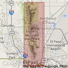
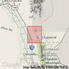
[Type locality:] section measured along western flank of Franklin Mountains, opposite Vinton, [Vinton Canyon, approx. Lat. 31 deg. 58 min. 00 sec. N., Long. 106 deg. 31 min. 30 sec. W., Canutillo 7.5-min quadrangle], El Paso Co., western TX (see also Harbour, 1972).
Source: Publication; US geologic names lexicon (USGS Bull. 1200, p. 354).
- Usage in publication:
-
- Bishop Cap member*
- Modifications:
-
- Principal reference
- Biostratigraphic dating
- Adopted
- Dominant lithology:
-
- Shale
- Limestone
- AAPG geologic province:
-
- Orogrande basin
Summary:
Pg. 43-50, pls. Bishop Cap Member of Magdalena Formation. Consists mostly of poorly exposed shale (75 percent) interbedded with thin beds of cliff-forming limestone. Thickness 636 feet. Overlies Berino Member and underlies unnamed upper member [=Panther Seep Formation], both of Magdalena Formation. Fossils indicate Desmoinesian.
Originally published as Bishops Cap, the geologic name is changed in this report to agree with spelling of the place name Bishop Cap. (Bishop Cap Member of Magdalena Formation adopted by the USGS, 1972.)
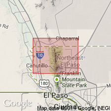
[Type locality:] in Vinton Canyon, 2 to 3 mi east of Westway on western flank of Franklin Mountains, [approx. Lat. 31 deg. 58 min. 00 sec. N., Long. 106 deg. 31 min. 30 sec. W., Canutillo 7.5-min quadrangle], El Paso Co., western TX (see also Nelson, 1940).
Source: Publication.
- Usage in publication:
-
- Bishop Cap Formation
- Modifications:
-
- Revised
- AAPG geologic province:
-
- Orogrande basin
Summary:
Bishop Cap Formation of Magdalena Group. Raised to formation rank. Conformably underlies Panther Seep Formation which is geographically extended into northern part of Franklin Mountains, southeast Dona Ana County, New Mexico. Age is Middle Pennsylvanian (middle Desmoinesian).
Source: Publication; GNU records (USGS DDS-6; Denver GNULEX).
- Usage in publication:
-
- Bishop Cap Formation
- Modifications:
-
- Revised
Kues, B.S., 2001, The Pennsylvanian System in New Mexico; Overview with suggestions for revisions of stratigraphic nomenclature: New Mexico Bureau of Geology and Mineral Resources, New Mexico Geology, v. 23, no. 4, p. 103-122.
Summary:
Pg. 106-107 (fig. 3, strat. chart), 116. Bishop Cap Formation. Previously a formation of Magdalena Group (citing D.V. LeMone, 1982, West Texas Geol. Soc. Pub. no. 82-76, p. 42-72; D.V. LeMone, 1992, West Texas Geol. Soc. Pub. no. 92-92, p. 63-69); [use of Magdalena Group discarded]. Recognized in Franklin Mountains, New Mexico-Texas. Consists of gray to brown shale (65 to 75 percent) alternating with thin ledges of gray limestone. Thickness up to 590 feet (180 m). Underlies Panther Seep Formation. Age is Middle to Late Pennsylvanian (middle Desmoinesian to early Missourian).
Source: Publication.
For more information, please contact Nancy Stamm, Geologic Names Committee Secretary.
Asterisk (*) indicates published by U.S. Geological Survey authors.
"No current usage" (†) implies that a name has been abandoned or has fallen into disuse. Former usage and, if known, replacement name given in parentheses ( ).
Slash (/) indicates name conflicts with nomenclatural guidelines (CSN, 1933; ACSN, 1961, 1970; NACSN, 1983, 2005, 2021). May be explained within brackets ([ ]).