

- Usage in publication:
-
- Bisher member
- Modifications:
-
- Named
- Dominant lithology:
-
- Limestone
- AAPG geologic province:
-
- Cincinnati arch
Summary:
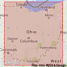
Named Bisher member of West Union formation. Composed predominantly of limestone. Underlain by Crab Orchard clay shale; overlain by Lilley member of West Union formation. Recognized in vicinity of Hillsboro, Highland Co., OH.
Source: GNU records (USGS DDS-6; Reston GNULEX).
- Usage in publication:
-
- Bisher formation
- Modifications:
-
- Revised
- Areal extent
- AAPG geologic province:
-
- Cincinnati arch
Summary:
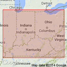
Raised in rank to Bisher formation. Originally defined as Bisher member of West Union formation. Herein redefined to include all strata of West Union formation, which is apparently abandoned. Underlain by Alger clay shale; overlain by Lilley dolomite. Occurs over wide area in Highland and Adams Cos., OH. Known to occur in Lewis Co., KY.
Source: GNU records (USGS DDS-6; Reston GNULEX).
- Usage in publication:
-
- Bisher Limestone*
- Modifications:
-
- Revised
- AAPG geologic province:
-
- Cincinnati arch
Summary:
Designated Bisher Limestone. Described as light-gray limestone, ranging from finely crystalline to coarse-textured and sandy, dolomitic; highly fossiliferous. Thickness ranges from 20 to 80 ft. Underlain by Crab Orchard Formation; unconformably overlain by Devonian Ohio Shale.
Source: GNU records (USGS DDS-6; Reston GNULEX).
- Usage in publication:
-
- Bisher Dolomite*
- Modifications:
-
- Revised
- Redescribed
- Dominant lithology:
-
- Dolomite
- AAPG geologic province:
-
- Cincinnati arch
Summary:
Designated Bisher Dolomite. Described as light-bluish-gray dolomite, medium- to coarse-grained, porous, vuggy, petroliferous; evenly laminated or obscurely or irregularly bedded, locally cross-bedded. Breccia common in lowermost few inches to 1 foot. Fossiliferous. Thickness ranges from 0 to 5 ft. Underlain by Crab Orchard Formation; unconformably overlain by Devonian black shale.
Source: GNU records (USGS DDS-6; Reston GNULEX).
For more information, please contact Nancy Stamm, Geologic Names Committee Secretary.
Asterisk (*) indicates published by U.S. Geological Survey authors.
"No current usage" (†) implies that a name has been abandoned or has fallen into disuse. Former usage and, if known, replacement name given in parentheses ( ).
Slash (/) indicates name conflicts with nomenclatural guidelines (CSN, 1933; ACSN, 1961, 1970; NACSN, 1983, 2005, 2021). May be explained within brackets ([ ]).