

- Usage in publication:
-
- Birch Creek limestone*
- Modifications:
-
- Original reference
- Dominant lithology:
-
- Limestone
- AAPG geologic province:
-
- Chautauqua platform
Summary:
Pg. 17-19. Birch Creek limestone. Hard, light-gray, crystalline, somewhat dolomitic limestone, sparingly fossiliferous. Thickness 4+/- feet. Laterally it grades into limy sandstone. Is overlain and underlain by thick sandstones. Lies 70 to 115 feet below Bigheart sandstone in T. 24 N., R. 10 E. Age is Pennsylvanian.
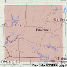
Named from exposure in bluffs on north side of Birch Creek, near eastern edge of SE/4 sec. 25, T. 24 N., R. 10 E., Osage Co., central northern OK.
Source: US geologic names lexicon (USGS Bull. 896, p. 190-191).
For more information, please contact Nancy Stamm, Geologic Names Committee Secretary.
Asterisk (*) indicates published by U.S. Geological Survey authors.
"No current usage" (†) implies that a name has been abandoned or has fallen into disuse. Former usage and, if known, replacement name given in parentheses ( ).
Slash (/) indicates name conflicts with nomenclatural guidelines (CSN, 1933; ACSN, 1961, 1970; NACSN, 1983, 2005, 2021). May be explained within brackets ([ ]).