

- Usage in publication:
-
- Bingen sands
- Modifications:
-
- Original reference
- Dominant lithology:
-
- Sand
- Clay
- AAPG geologic province:
-
- Arkla basin
- Ouachita folded belt
Summary:
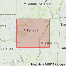
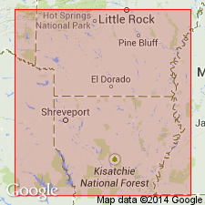
Pg. 56-58. Bingen sands. Extensive arenaceous formation, consisting of fine white quartz sand with occasional thin beds of lignite. Can only be classified as isolated outcrops of concealed westward continuation of upper and lower beds of typical Camden series. Includes many nodular concretions of iron ore and often extensive layers of ferruginous sandstone. Constitutes most of sandy uplands of eastern Howard, western Hempstead, southern Sevier, Little River, Nevada, and Clark Counties, Arkansas. Occupies same relative position above Arkadelphia shales as does Camden series. Included in Eocene.
Named from exposures near Bingen, Hemstead Co., southwestern AR.
Source: US geologic names lexicon (USGS Bull. 896, p. 189).
- Usage in publication:
-
- Bingen sand
- Modifications:
-
- Age modified
Summary:
Table opp. p. 16, p. 23-25. Bingen sand. Near-shore deposits, of white or brown sands and clays containing some greensand and considerable lignite or lignitiferous matter. Maximum thickness over 500 feet. Basal formation of Upper Cretaceous. Time equivalent of Woodbine sand, Eagle Ford clay, and Sub-Clarksville sand [Blossom sand]. Underlies Brownstown formation and overlies Washita group.
Source: US geologic names lexicon (USGS Bull. 896, p. 189).

- Usage in publication:
-
- Bingen formation†
- Bingen sand†
- Modifications:
-
- Abandoned
- AAPG geologic province:
-
- Arkla basin
- Ouachita folded belt
Summary:
Upper Cretaceous (Gulfian series) †Bingen formation (also †Bingen sand) now [ca. 1938] divided into Tokio formation above and Woodbine sand below. See under Tokio formation.
[Previously recognized in southwestern Arkansas, southeastern Oklahoma, and northwestern Louisiana.]
Source: US geologic names lexicon (USGS Bull. 896, p. 189).
For more information, please contact Nancy Stamm, Geologic Names Committee Secretary.
Asterisk (*) indicates published by U.S. Geological Survey authors.
"No current usage" (†) implies that a name has been abandoned or has fallen into disuse. Former usage and, if known, replacement name given in parentheses ( ).
Slash (/) indicates name conflicts with nomenclatural guidelines (CSN, 1933; ACSN, 1961, 1970; NACSN, 1983, 2005, 2021). May be explained within brackets ([ ]).