- Usage in publication:
-
- Biloxi sand
- Modifications:
-
- Named
- Dominant lithology:
-
- Sand
- AAPG geologic province:
-
- Mid-Gulf Coast basin
Summary:
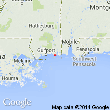
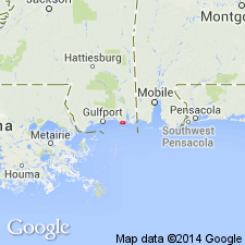
Pleistocene sand deposits of the strip immediately adjoining the salt water of Mississippi Sound are referred to here as the Biloxi sands. The strip varies from zero to a width of several mi, stretching from the Rigolets (or mouth of Pearl River) to Mobile Bay. Consists essentially of thin alternating layers of sand and yellowish brown or blue clay, similar to deposits now accumulating upon the floor of the sound. Thickness from borings at Biloxi, Pass Christian, and others places, 80 or 100 feet.
Source: GNU records (USGS DDS-6; Reston GNULEX).

- Usage in publication:
-
- Biloxi Formation
- Modifications:
-
- Areal extent
- AAPG geologic province:
-
- Mid-Gulf Coast basin
Summary:
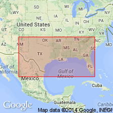
Biloxi Formation is typically a 3- to 15-m-thick, fossiliferous, fine-clastic, shallow subsurface unit. It occurs along the entire northern Gulf Coast, thinning to a "veneer" at Carrabelle, Franklin Co., FL. A feather edge extends inland beneath the Prairie Formation. Unit probably correlates with thin, marine, "Pamlico Terrace" deposits of western Florida peninsula. Represents a full spectrum of brackish and marine depositional environments. Overlies late Neogene or older Quaternary alluvium.
Source: GNU records (USGS DDS-6; Reston GNULEX).

- Usage in publication:
-
- Biloxi Formation*
- Modifications:
-
- Biostratigraphic dating
- AAPG geologic province:
-
- Mid-Gulf Coast basin
Summary:
Biostratigraphic analyses of well-preserved mollusks in samples from Biloxi Formation at Belle Fontaine corehole #1 indicate deposition during late Pleistocene, probably during Sangamon Interglaciation. Conclusion is based on 1) relatively high Jaccard coefficients for Biloxi in pair-groups with late Pleistocene Socastee Formation of SC and informal units Q2 and Q3 of McCartan (1990), and 2) occurrence of mollusk zone M1 and M2 stratigraphically important (according to Blackwelder, 1980) species BUSYCON SPIRATUM, CHIONE CANCELLATA, CHIONE GRUS, DOSINIA ELEGANS, and MULINIA LATERALIS, as well as ANADARA OVALIS which is only found in late Pleistocene M2 mollusk zone.
Source: GNU records (USGS DDS-6; Reston GNULEX).

- Usage in publication:
-
- Biloxi Formation*
- Modifications:
-
- Biostratigraphic dating
- AAPG geologic province:
-
- Mid-Gulf Coast basin
Summary:
Biloxi Formation is an important late Pleistocene unit that represents a period of warm climate and high sea level during last interglacial period. In Belle Fontaine #1 corehole, Biloxi consists of clay and well-sorted sand about 25 ft thick. More than 42 species of ostracodes were found in the corehole samples. Most common are HULINGSINA, CYTHERURA, CLIMACOIDEA (PROTEOCONCHA), LOXOCONCHA, and PERATOCYTHERIDEA. LOXOCONCHA MORALESI and PERATOCYTHERIDEA BRADYI are the most common species. In general, this is a late Pleistocene and Holocene fauna that lacks characteristic Neogene or early Pleistocene species. Report includes fossil lists and geologic column.
Source: GNU records (USGS DDS-6; Reston GNULEX).
For more information, please contact Nancy Stamm, Geologic Names Committee Secretary.
Asterisk (*) indicates published by U.S. Geological Survey authors.
"No current usage" (†) implies that a name has been abandoned or has fallen into disuse. Former usage and, if known, replacement name given in parentheses ( ).
Slash (/) indicates name conflicts with nomenclatural guidelines (CSN, 1933; ACSN, 1961, 1970; NACSN, 1983, 2005, 2021). May be explained within brackets ([ ]).

