

- Usage in publication:
-
- Bill's Creek beds
- Modifications:
-
- Original reference
- Dominant lithology:
-
- Shale
- AAPG geologic province:
-
- Michigan basin
Summary:
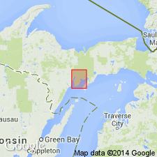
Pg. 113-150. Bill's Creek beds. Largely thin-bedded shale, with a few thin layers of interbedded argillaceous limestone, highly fossiliferous. Chief exposures on Bill's Creek and along eastern shore of Little Bay de Noc, Delta County, northern Michigan. Total thickness about 88 feet. The lowest beds of Upper Ordovician Richmond formation of Stonington region of Michigan. Disconformably overlain by Bay de Noc member of Stonington beds. Lower part of the beds may not belong to the Richmond.
Type locality: along Bill's Creek, 5 mi northeast of Rapid River, in sec. 7, T. 41 N., R. 20 W., and in sec. 12, T. 41 N., R. 21 W., [Rapid River 15-min quadrangle], Delta Co., northern MI.
Source: US geologic names lexicon (USGS Bull. 896, p. 188-189).
- Usage in publication:
-
- Bill's Creek beds
- Modifications:
-
- Areal extent
- AAPG geologic province:
-
- Michigan basin
Summary:
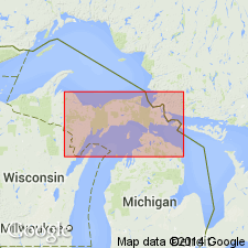
Pg. 13, 14 (table), 40-45. Bill's Creek beds of Richmond formation. Overlie Haymeadow Creek member (new) of Trenton formation. Unit termed Haymeadow Creek was formerly included in basal Bill's Creek beds. Maximum thickness of beds 80 feet; lower 20 feet are now correlated with Collingwood which some workers consider late Trenton. Thickness at type locality about 62 feet. Underlie Stonington beds [or member] of Richmond. Contact with overlying Stonington beds is disconformable. Age is Late Ordovician.
Type locality: along Bill's Creek, 5 mi northeast of Rapid River, in sec. 7, T. 41 N., R. 20 W., and in sec. 12, T. 41 N., R. 21 W., [Rapid River 15-min quadrangle], Delta Co., northern MI.
Source: Publication; US geologic names lexicon (USGS Bull. 1200, p. 344).
- Usage in publication:
-
- Bills Creek shale
- Modifications:
-
- Revised
- AAPG geologic province:
-
- Michigan basin
Summary:
Chart 2 (column 46). Chart shows Bill's Creek shale below Bay de Noc limestone. Age is Late Ordovician (Cincinnatian; Richmondian).
Source: Publication; US geologic names lexicon (USGS Bull. 1200, p. 344).
For more information, please contact Nancy Stamm, Geologic Names Committee Secretary.
Asterisk (*) indicates published by U.S. Geological Survey authors.
"No current usage" (†) implies that a name has been abandoned or has fallen into disuse. Former usage and, if known, replacement name given in parentheses ( ).
Slash (/) indicates name conflicts with nomenclatural guidelines (CSN, 1933; ACSN, 1961, 1970; NACSN, 1983, 2005, 2021). May be explained within brackets ([ ]).