The National Geologic Map Database is migrating to a new infrastructure. We apologize for any service disruptions during this process.
|
|---|


- Usage in publication:
-
- Billings Hill formation
- Modifications:
-
- Named
- Dominant lithology:
-
- Gneiss
- Granulite
Summary:
Pg. 11 (table 1), 33-36, pls. 1, 2. Billings Hill formation [author does not capitalize rank terms; however, units are considered formal]. Coarse-grained rusty weathering migmatitic gneiss and some biotite granulite. Light fraction consists of pegmatitic quartz and plagioclase. Dark fraction consists mainly of coarse two-mica-sillimanite schist. Thickness 2,000 feet. Overlies Shagg Pond formation (new). Is top of Siluro-Devonian sequence immediately below the Devonian Littleton formation.Group (new).
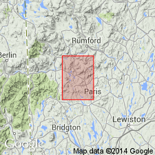
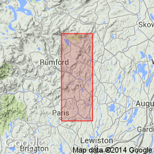
Type locality: along brook that parallels Billings Hill Road on west side of Billings Hill, Bryant Pond quadrangle, Oxford Co., ME. Unit is present in broad belt that covers much of Spruce Mountain and Billings Hill.
Source: US geologic names lexicon (USGS Bull. 1350, p. 70).
- Usage in publication:
-
- Billings Hill Formation
- Modifications:
-
- Revised
- AAPG geologic province:
-
- New England province
Summary:
Pg. 112 (fig. 2). Billings Hill Formation included in Woodstock Group (new).
Source: US geologic names lexicon (USGS Bull. 1350, p. 70).
For more information, please contact Nancy Stamm, Geologic Names Committee Secretary.
Asterisk (*) indicates published by U.S. Geological Survey authors.
"No current usage" (†) implies that a name has been abandoned or has fallen into disuse. Former usage and, if known, replacement name given in parentheses ( ).
Slash (/) indicates name conflicts with nomenclatural guidelines (CSN, 1933; ACSN, 1961, 1970; NACSN, 1983, 2005, 2021). May be explained within brackets ([ ]).