

- Usage in publication:
-
- Bigfork chert
- Modifications:
-
- Original reference
- Dominant lithology:
-
- Chert
- AAPG geologic province:
-
- Ouachita folded belt
Summary:
Pg. 30, 35; GSA Bull., v. 19, p. 557, 1909 [abs.]. Bigfork chert. Close-textured, even-bedded, siliceous rock in layers 1 to 18 inches thick; of slate to dark-gray color; very friable. In places thickly set with network of fine quartz veins. Weathered portions have appearance of fine-grained, gray weathered sandstone. Usually layers are crumpled to astonishing degree. Thickness 700 feet. Overlies [unconformably] Stringtown shale and underlies Polk Creek shale. [Stringtown shale now abandoned, for Womble shale.] Age is Middle Ordovician.
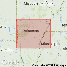
[Recognized in southwestern AR and southeastern OK. Named from development over large area around Bigfork P.O., Montgomery Co., southwestern AR.]
Source: US geologic names lexicon (USGS Bull. 896, p. 184).
- Usage in publication:
-
- Bigfork chert*
- Modifications:
-
- Areal extent
- AAPG geologic province:
-
- Ouachita folded belt
Summary:
Pg. 781 (fig. 2), 782, 783-787. Bigfork chert. Geographically extended into Ouachita Mountains, southeastern Oklahoma, where it is well exposed at Black Knob Ridge and in the Potato Hills. At Black Knob Ridge, light- to dark-gray hard cryptocrystalline well-bedded cherty highly siliceous limestone with thin layers of coarsely crystalline limestone; upper part consists of alternating chert and marly shale or shale beds ranging from 1 inch to 2 feet in thickness. About 600 feet thick. Conformably underlies Polk Creek shale; overlies Womble shale. Upper Ordovician.
Source: US geologic names lexicon (USGS Bull. 1200, p. 333).

- Usage in publication:
-
- Bigfork Chert*
- Bigfork Formation*
- Modifications:
-
- Overview
- AAPG geologic province:
-
- Ouachita folded belt
Summary:
Pg. 19-20. Bigfork Chert; Bigfork Formation. Thin bedded, dark gray, cryptocrystalline chert interbedded with varying amounts of black siliceous shale, calcareous siltstone, and dense, bluish gray limestone. The cherts normally occur in thin to medium beds and are usually highly fractured. The interbedded siliceous shales occur in thin to thick sequences and are often pyritic. The limestones occur mostly as interbeds in the chert and typically weather to a soft brown layer. The limestones are more common in northwestern exposures. Thickness from about 450 feet thick in the northern Ouachitas to about 750 feet thick in the southern Ouachitas. Conformably overlies Womble Shale. Fossils are rare but fragments of brachiopods, crinoids, sponges, conodonts, and graptolites have been reported. Age is Middle and Late Ordovician.
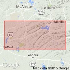
Recognized in Ouachita Mountains, west-central AR, and in southeastern OK.
Source: Publication.
For more information, please contact Nancy Stamm, Geologic Names Committee Secretary.
Asterisk (*) indicates published by U.S. Geological Survey authors.
"No current usage" (†) implies that a name has been abandoned or has fallen into disuse. Former usage and, if known, replacement name given in parentheses ( ).
Slash (/) indicates name conflicts with nomenclatural guidelines (CSN, 1933; ACSN, 1961, 1970; NACSN, 1983, 2005, 2021). May be explained within brackets ([ ]).