The National Geologic Map Database is migrating to a new infrastructure. We apologize for any service disruptions during this process.
|
|---|


- Usage in publication:
-
- Big Valley Mountains volcanic series
- Modifications:
-
- Named
- Dominant lithology:
-
- Basalt
- Sand
- Tuff
- AAPG geologic province:
-
- Great Basin province
Summary:
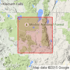
[Probably named for Big Valley Mountains in northeast CA]. Big Valley constitutes broad plain about 13 mi long from north to south, and 15 mi wide from east to west with northern part in Modoc Co and southern part in Lassen Co, CA. Big Valley Mountains are on west and Barber Ridge on east. Series is composed of basalt flows and minor beds of sand, tuff, and diatomite. Thickness is as much as 4000 feet. May be correlative in part with Turner Creek formation (new). Upper part is composed of about 400 feet of basalt which has uniform easterly dip suggesting it may extend beneath floor of Big Valley where its depth would be several thousand feet. Age is Miocene to Pliocene.
Source: GNU records (USGS DDS-6; Menlo GNULEX).
For more information, please contact Nancy Stamm, Geologic Names Committee Secretary.
Asterisk (*) indicates published by U.S. Geological Survey authors.
"No current usage" (†) implies that a name has been abandoned or has fallen into disuse. Former usage and, if known, replacement name given in parentheses ( ).
Slash (/) indicates name conflicts with nomenclatural guidelines (CSN, 1933; ACSN, 1961, 1970; NACSN, 1983, 2005, 2021). May be explained within brackets ([ ]).