- Usage in publication:
-
- Big Three oil-shale zone*
- Modifications:
-
- Overview
- AAPG geologic province:
-
- Piceance basin
Summary:
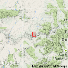
Is an informal unit in either the Piceance Creek Member or the Parachute Creek Member [discrepancy in GNU files] of Green River Formation (Eocene) in the Piceance Creek basin, northwestern CO. [Piceance Creek basin is generally defined as the smaller Tertiary oil-shale basin within Piceance basin.] Most U.S. Geological Survey reports dealing with oil-shale resources of Green River Formation in Piceance Creek basin divide the oil-shale sequence into informal named or numbered rich and lean zones, and some widely recognized key marker beds, mostly above Mahogany oil-shale zone. Numbered rich oil-shale zones are designated "R"; lean zones are designated "L". The zones are (ascending): Orange zone, R-1, L-1, R-2, L-2, R-3, L-3, R-4, L-4, R-5, L-5, R-6, B groove, Mahogany (rich zone), A groove, Four Senators, Stillwater, and Big Three. Orange zone, B groove, and A groove are usually not regarded as oil-shale zones, but as mostly barren zones. B groove and A groove mark the base and top, respectively, of Mahogany zone. The Four Senators, Stillwater, and Big Three are distinctive groups of rich oil-shale beds that are more commonly regarded as stratigraphic markers than rich oil-shale zones. The base of Parachute Creek Member in Piceance Creek basin is generally placed at or near base of R-2 oil-shale zone. Correlation in central Roan Plateau area (figs 8 and 9).
Source: GNU records (USGS DDS-6; Denver GNULEX).
For more information, please contact Nancy Stamm, Geologic Names Committee Secretary.
Asterisk (*) indicates published by U.S. Geological Survey authors.
"No current usage" (†) implies that a name has been abandoned or has fallen into disuse. Former usage and, if known, replacement name given in parentheses ( ).
Slash (/) indicates name conflicts with nomenclatural guidelines (CSN, 1933; ACSN, 1961, 1970; NACSN, 1983, 2005, 2021). May be explained within brackets ([ ]).

