The National Geologic Map Database is migrating to a new infrastructure. We apologize for any service disruptions during this process.
|
|---|


- Usage in publication:
-
- Big Spring member
- Modifications:
-
- Original reference
- Dominant lithology:
-
- Dolomite
- Sandstone
- Shale
- Limestone
- AAPG geologic province:
-
- Appalachian basin
Summary:
Pg. 45, 55-56. Big Spring member of Conococheague formation. Name applied to basal unit of the Conococheague as described in section measured at Big Spring, Maryland [= type section]. Consists mainly of dolomite, shale, sandstone beds, oolite and cryptozoon limestone. Thickness 312 feet. Underlies dolomite beds in middle part of formation; overlies Elbrook formation. Name credited to J.L. Wilson.
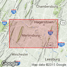
Type section: at RR cuts north of and in fields west of Big Spring Station on Western Maryland RR about 3 mi south of Clear Spring, Washington Co., northwestern MD.
Source: US geologic names lexicon (USGS Bull. 1200, p. 340-341); supplemental information from GNU records (USGS DDS-6; Reston GNULEX).
- Usage in publication:
-
- Big Spring Station member
- Modifications:
-
- Original reference
- Dominant lithology:
-
- Siltstone
- Dolomite
- Sandstone
- AAPG geologic province:
-
- Appalachian basin
Summary:
Pg. 307-308, pl. 3. Big Spring Station member of Conococheague formation. Formally proposed as Big Spring Station member. Member is best defined by abundant beds of platy yellow-weathering dolomitic siltstone or silty dolomite and coarsely arenaceous dolomite or siliceous orthoquartzite; some of the latter beds are 4 to 5 feet thick, although generally the rock type occurs in thinner layers interbedded with typical laminated limestone of the higher Conococheague. Upper boundary arbitrarily drawn at top of uppermost orthoquartzite or very arenaceous limestone within lower group of Conococheague sandstones; lower limit of member (and formation) arbitrarily drawn at lowest of these sandstone beds; the buff-yellow weathering silty dolomite in the Big Spring Station is the same type as that in the underlying Elbrook formation, and boundary between two units is gradational if sandy layers are not considered.
Type section: at RR cuts north of and in fields west of Big Spring Station on Western Maryland RR about 3 mi south of Clear Spring, Washington Co., northwestern MD. [Type section is described in Cloos (1951).]
Source: US geologic names lexicon (USGS Bull. 1200, p. 340-341); supplemental information from GNU records (USGS DDS-6; Reston GNULEX).
- Usage in publication:
-
- Big Spring Station Member
- Modifications:
-
- Areal extent
- AAPG geologic province:
-
- Appalachian basin
Summary:
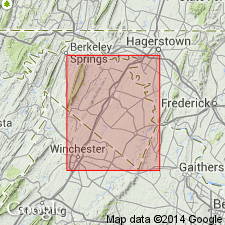
Geographically extended the Big Spring Station Member of the Conococheague Formation into eastern WV.
Source: GNU records (USGS DDS-6; Reston GNULEX).
- Usage in publication:
-
- Big Spring Station Member
- Modifications:
-
- Areal extent
- AAPG geologic province:
-
- Appalachian basin
Summary:
Geographically extended the Big Spring Station Member of the Conococheague Formation into northern VA. Consists of interbedded dolomite, magnesian limestone, and limestone with a few thin beds of sandy dolomite, brownish weathering shale, quartzose sandstone and stringers of chert. Thickness is 100 to 200 feet. Overlies the Elbrook Formation and underlies the remainder of the Conococheague.
Source: GNU records (USGS DDS-6; Reston GNULEX).
For more information, please contact Nancy Stamm, Geologic Names Committee Secretary.
Asterisk (*) indicates published by U.S. Geological Survey authors.
"No current usage" (†) implies that a name has been abandoned or has fallen into disuse. Former usage and, if known, replacement name given in parentheses ( ).
Slash (/) indicates name conflicts with nomenclatural guidelines (CSN, 1933; ACSN, 1961, 1970; NACSN, 1983, 2005, 2021). May be explained within brackets ([ ]).