- Usage in publication:
-
- Big Basin sandstone
- Modifications:
-
- Original reference
- Dominant lithology:
-
- Sandstone
- AAPG geologic province:
-
- Anadarko basin
Summary:
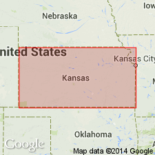
Pg. 46-48. Big Basin sandstone. Rather massive, blocky, red and grayish white sandstone, 0 to 12 feet thick, forming top formation of Kiger division. Overlies Hackberry shales and unconformably underlies a remnant of Belvidere beds (Cretaceous). Age is Permian.
[Named from Big Basin, a depression in Clark Co., central southern KS.]
Source: US geologic names lexicon (USGS Bull. 896, p. 180); GNC KS-NE Permian Corr. Chart, Oct. 1936.
- Usage in publication:
-
- Big Basin sandstone
- Modifications:
-
- Revised
Cragin, F.W., 1897, Observations on the Cimarron series: American Geologist, v. 19, p. 351-363.
Summary:
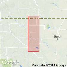
Pg. 362-363. Taloga formation is proposed to include Big Basin sandstone and Hackberry shale. [See under Taloga formation.]
Source: US geologic names lexicon (USGS Bull. 896, p. 180).
- Usage in publication:
-
- Big Basin sandstone
- Modifications:
-
- Areal extent
- AAPG geologic province:
-
- Anadarko basin
Summary:
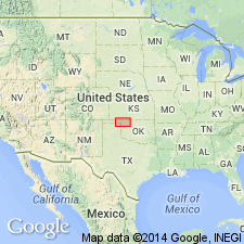
Big Basin sandstone is well exposed in Harper County, Oklahoma, where it is overlain by beds perhaps referable to Cloud Chief gypsum. Age is Permian.
Source: US geologic names lexicon (USGS Bull. 896, p. 180).
- Usage in publication:
-
- Big Basin sandstone
- Modifications:
-
- Not used
- AAPG geologic province:
-
- Anadarko basin
Summary:
Pg. 405-432. Day Creek dolomite overlies Cloud Chief gypsum, instead of underlying it, as previously believed, and all Permian beds above Day Creek dolomite in Oklahoma and Kansas belong to Quartermaster formation. The Kansas terms "Hackberry" and "Big Basin" should be dropped. Writer has not anywhere seen beds of gypsum in Quartermaster formation. The Quartermaster rests conformably on Day Creek dolomite. The Cloud Chief is here made a member of Whitehorse formation.
Source: US geologic names lexicon (USGS Bull. 896, p. 180, Quartermaster entry p. 1753).
- Usage in publication:
-
- Big Basin formation*
- Modifications:
-
- Redescribed
- Dominant lithology:
-
- Sandstone
- Shale
- AAPG geologic province:
-
- Anadarko basin
- Sedgwick basin
Summary:
Pg. 1760-1761 (fig. 1), 1764-1765 (fig. 3), 1813-1814. Big Basin formation of Cimarron group. Overlying Day Creek dolomite are 65 feet of Permian red beds which Cragin named Hackberry shales and Big Basin sandstone. Name Hackberry being preoccupied, it has been dropped but Big Basin has been retained. Because these strata can be considered one formation of sand beds interstratified with beds of silty and sandy shale, they are herein considered to be one formation and all beds between Day Creek dolomite and top of Permian red beds of Kansas (here covered by Cretaceous) are termed Big Basin formation. Should further work establish correlation of lower shaly part of formation with Doxey shale member of Oklahoma Quartermaster formation, name Big Basin would be restricted to the sand beds alone, the possible equivalent of Elk City sandstone member of Quartermaster. At present, interrelations of type Quartermaster with Day Creek dolomite and so-called Cloud Chief member of Whitehorse have not been definitely established. Writer [Norton] believes that Evans (1931, AAPG Bull., v. 15, no. 4) was not justified in attempting to drop Kansas nomenclature. Lowermost 25 feet is silty shale, and lower 7 feet of this shaly member is gray-green at some localities. Upper and more prominent part of formation consists of 40 feet of sandstones and sandy shales, both locally lithified to varying extent. Kiger division of Cimarron series. [Age is Permian.]
Source: US geologic names lexicon (USGS Bull. 1200, p. 326).
- Usage in publication:
-
- Big Basin Formation
- Modifications:
-
- Overview
- Dominant lithology:
-
- Shale
- Siltstone
- Sandstone
- AAPG geologic province:
-
- Anadarko basin
Summary:
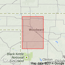
(Paleozoic Era; Permian System by H.G. O'Connor, D.E. Zeller, C.K. Bayne, J.M Jewett, and Ada Swineford, p. 53.) Big Basin Formation. Beds of red silty shale, siltstone, dolomitic siltstone, and very fine-grained feldspathic sandstone, the "Taloga" of earlier reports, belong to the Big Basin Formation (citing H.G. O'Connor, 1963, AAPG Bull., v. 47, p. 1873-1877). Exposed in western Clark and eastern Meade Counties, Kansas. Seemingly equivalent all or in part, to the Quartermaster Formation in Oklahoma. Maximum exposed thickness about 45 feet. Occurs above Day Creek Dolomite. Age is Late Permian; Custerian Provincial Stage (of R.O. Fay, 1965, Oklahoma Geol. Survey Bull., no. 106, 189 p.).
Source: Publication.
For more information, please contact Nancy Stamm, Geologic Names Committee Secretary.
Asterisk (*) indicates published by U.S. Geological Survey authors.
"No current usage" (†) implies that a name has been abandoned or has fallen into disuse. Former usage and, if known, replacement name given in parentheses ( ).
Slash (/) indicates name conflicts with nomenclatural guidelines (CSN, 1933; ACSN, 1961, 1970; NACSN, 1983, 2005, 2021). May be explained within brackets ([ ]).

