

- Usage in publication:
-
- Bidarka formation
- Modifications:
-
- Named
- Dominant lithology:
-
- Sandstone
- Shale
- Limestone
- AAPG geologic province:
-
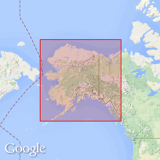
- Alaska Southwestern region
- Alaska Peninsula province
Summary:
Named and described in stratigraphic column as occurring in Cold Bay section, Alaska Peninsula, southwestern AK. Consists of lower part of 1000 ft (massive to thin-bedded tuffaceous sandstone and interbedded calcareous shale and limestones) and upper part of 1300 ft (dark gray-black shale with occasional thin beds of light colored coarse-grained, well-indurated sandstone). Overlies Kamishak formation; at Cold Bay disconformably underlies Shelikof formation. Stratigraphic interval between Kialagvik formation on Wide Bay anticline and Bidarka formation cannot be estimated. No evidence that Kialagvik is present in Cold Bay. Age given as Early Jurassic (partly based on ASTARTE sp. D in lower part).
Source: GNU records (USGS DDS-6; Menlo GNULEX).
For more information, please contact Nancy Stamm, Geologic Names Committee Secretary.
Asterisk (*) indicates published by U.S. Geological Survey authors.
"No current usage" (†) implies that a name has been abandoned or has fallen into disuse. Former usage and, if known, replacement name given in parentheses ( ).
Slash (/) indicates name conflicts with nomenclatural guidelines (CSN, 1933; ACSN, 1961, 1970; NACSN, 1983, 2005, 2021). May be explained within brackets ([ ]).