- Usage in publication:
-
- Bettridge Creek Granodiorite*
- Modifications:
-
- Named
- Geochronologic dating
- Dominant lithology:
-
- Granodiorite
- AAPG geologic province:
-
- Great Basin province
Summary:
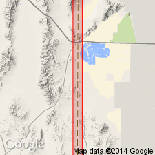
Named for exposures in canyon north of Bettridge Creek, sec 16, T4N, R19W, Pilot Peak 7.5 quad, Box Elder Co, UT, Great Basin province. Is a small pluton with an areal extent of about 1 sq km with dikes and other small bodies. Composed of homogeneous, foliated, medium- to coarse-grained hornblende-biotite granodiorite with apatite and zircon as accessory minerals. The hornblende is dark green. The biotite is green to brown, and some is altered to chlorite. Foliation is weak to moderate. Has abundant xenoliths less than 8 cm in diameter that are approximately hornblende diorite in composition. Intruded low- and high-angle faults and folds, and retrograded upper? greenschist facies rocks in footwall of Pilot Peak decollement to lower greenschist facies. Was emplaced about 39 Ma [or Eocene]. Isotopic data. Geologic map.
Source: GNU records (USGS DDS-6; Denver GNULEX).
For more information, please contact Nancy Stamm, Geologic Names Committee Secretary.
Asterisk (*) indicates published by U.S. Geological Survey authors.
"No current usage" (†) implies that a name has been abandoned or has fallen into disuse. Former usage and, if known, replacement name given in parentheses ( ).
Slash (/) indicates name conflicts with nomenclatural guidelines (CSN, 1933; ACSN, 1961, 1970; NACSN, 1983, 2005, 2021). May be explained within brackets ([ ]).

