

- Usage in publication:
-
- Bethany Falls limestone
- Modifications:
-
- Original reference
- Dominant lithology:
-
- Limestone
Summary:
Bethany Falls limestone. Upper 7 inches fine-grained, buff-colored, brittle, shelly, fucoidal limestone, with very few fossils; lower part irregularly and evenly bedded light-grayish or drab crystalline limestone weathering buff. Thickness 18 to 22 feet. Is bed 166 of detailed section of Coal Measures from northwest corner of Missouri to Glasgow, Howard County, Missouri.
Source: US geologic names lexicon (USGS Bull. 896, p. 174).
- Usage in publication:
-
- Bethany Falls limestone member
- Modifications:
-
- Revised
Summary:
Defined Bethany Falls limestone member of Kansas City formation as consisting, in northwest Missouri, of 15 to 25 feet of limestone (locally called "cotton rock") underlying Galesburg shale member and overlying Ladore shale member.
Source: US geologic names lexicon (USGS Bull. 896, p. 174-175).

- Usage in publication:
-
- Bethany Falls limestone
- Modifications:
-
- Overview
Summary:
Until 1932 Bethany Falls limestone was included in the Kansas City (which USGS treated as a formation in Missouri and Iowa and as a group in Kansas), and was defined as underlying Galesburg shale and overlying Ladore shale. In Jan. or Feb., 1932 (Nebraska Geol. Surv. Bull., 2nd ser., no. 5, p. 17-18), C.O. Dunbar, R.C. Moore, and G.E. Condra divided Bethany Falls limestone into (descending) Swope limestone, Sugar Creek shale, and Middle Creek limestone. Later in 1932 (Aug. 28 to Sept. 3) R.C. Moore (Kansas Geol. Soc. 6th Ann. Field. Conf. Gdbk.) used Swope limestone to include (descending) Bethany Falls limestone, Hushpuckney shale, Middle Creek limestone, Elm Branch shale, Sniabar limestone, Mound City shale, Critizer [Critzer] limestone, Tennison Creek shale, and Schubert Creek limestone; and this definition was repeated by Moore and Condra in their Oct. 1932 chart, and by Moore in his classification of May 1, 1935. N.D. Newell in his May 15, 1935, classification (Kansas Geol. Surv. Bull., no. 21) restricted Swope limestone to beds between top of Bethany Falls limestone member and base of Middle Creek limestone member. Also in 1932 Moore and Condra greatly restricted both Kansas City group and Ladore shale, and treated Swope limestone as basal formation of their Bronson group.
See also "Modern classifications of the Pennsylvanian rocks of eastern Kansas and southeastern Nebraska," compiled by M.G. Wilmarth, Secretary of Committee on Geologic Names, USGS unpub. corr. chart, Oct. 1936, 2 sheets.
Source: US geologic names lexicon (USGS Bull. 896, p. 174-175).

- Usage in publication:
-
- Bethany Falls limestone
- Modifications:
-
- Areal extent
Summary:
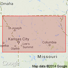
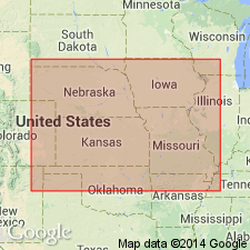
Pg. 86-88. Bethany Falls limestone, upper member of Swope limestone (restricted) of Bronson group. Bethany Falls limestone (Broadhead, 1868, Hinds and Greene, 1915, etc.) is traced from south-central Iowa (†Earlham limestone of Iowa Geol. Survey) to southern Kansas, near Oklahoma boundary. It was called †Mound Valley by early Kansas Geol. Survey, but Bethany Falls has priority. Lower part consists of 1 to 20 feet of light-gray, dense, thin-bedded limestone, in uneven, somewhat wavy layers with shale partings and fairly abundant fossils. Upper part consists of up to 7 feet of bluish-gray, massive, mottled or nodular limestone that is believed to be of algal origin, and locally of 13+/- feet of gray-white oolitic limestone. Total thickness of Bethany Falls limestone 12 to 27 feet; avgerage in east Kansas, 18+/- feet. Age is Late Pennsylvanian (Missouri age).
Source: US geologic names lexicon (USGS Bull. 896, p. 175); GNC KS-NE Pennsylvanian Corr. Chart, sheet 2, Oct. 1936.
- Usage in publication:
-
- Bethany Falls limestone*
- Modifications:
-
- Overview
Summary:
The name Bethany Falls has also been used in a broader sense, to include beds from top of Westerville limestone of Iowa reports to base of Hertha limestone, but this usage was long ago discarded.
Source: US geologic names lexicon (USGS Bull. 896, p. 174-175).
- Usage in publication:
-
- Bethany Falls limestone member
- Modifications:
-
- Revised
Summary:
Pg. 2031 (fig. 4). Bethany Falls limestone member, uppermost member of Swope limestone (or formation). Overlies Hushpuckney shale member; underlies Galesburg formation. This is classification agreed upon by state geological surveys of Iowa, Kansas, Missouri, Nebraska, and Oklahoma, May 1947.
Source: US geologic names lexicon (USGS Bull. 896, p. 318).
For more information, please contact Nancy Stamm, Geologic Names Committee Secretary.
Asterisk (*) indicates published by U.S. Geological Survey authors.
"No current usage" (†) implies that a name has been abandoned or has fallen into disuse. Former usage and, if known, replacement name given in parentheses ( ).
Slash (/) indicates name conflicts with nomenclatural guidelines (CSN, 1933; ACSN, 1961, 1970; NACSN, 1983, 2005, 2021). May be explained within brackets ([ ]).