- Usage in publication:
-
- Berryville Clay Member
- Modifications:
-
- Named
- Biostratigraphic dating
- Dominant lithology:
-
- Clay
- AAPG geologic province:
-
- South GA-North FL sedimentary province
- Atlantic Coast basin
Summary:
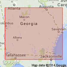
Berryville Clay Member of the Coosawhatchie Formation of Hawthorne Group here named in southeast GA. Offshore, on the continental shelf, the Berryville constitutes the entire Coosawhatchie, and at its type section near Berry Landing was previously referred to the Coosawhatchie Clay Member of the Hawthorne Formation (Ernissee, Abbott, and Huddlestun, 1977; Abbott and Andrews, 1979). Unit extends from Jasper Co., SC, along the coastal area and continental shelf of GA, to northeastern FL. Consists principally of yellowish gray to light olive gray, thin-bedded to laminated, silty phosphatic, calcareous in some areas, variably siliceous clay. Minor lithologies include quartz sand and silt. Dominant minerals are smectite in the type area and palygorskite offshore. Disconformably or paraconformably overlies the Marks Head Formation or gradationally overlies the Tybee Phosphorite Member (new name) in GA, but paraconformably overlies the Cooper Formation on the shelf. Grades laterally westward into the overlying Ebenezer Member (new name). The Berryville is at least 9 ft (2.7 m) thick at the type locality, but contacts are not exposed. Greatest known thickness in type area is 54 ft. A maximum thickness of 175 ft (53 m) is recorded offshore. Age is middle Miocene (early Serravallian) based on Foraminifera.
Source: GNU records (USGS DDS-6; Reston GNULEX).
For more information, please contact Nancy Stamm, Geologic Names Committee Secretary.
Asterisk (*) indicates published by U.S. Geological Survey authors.
"No current usage" (†) implies that a name has been abandoned or has fallen into disuse. Former usage and, if known, replacement name given in parentheses ( ).
Slash (/) indicates name conflicts with nomenclatural guidelines (CSN, 1933; ACSN, 1961, 1970; NACSN, 1983, 2005, 2021). May be explained within brackets ([ ]).

