

- Usage in publication:
-
- Berners formation*
- Modifications:
-
- Named
- Biostratigraphic dating
- Dominant lithology:
-
- Slate
- Graywacke
- AAPG geologic province:
-
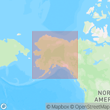
- Alaska Southeastern region
Summary:
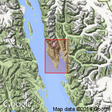
Well exposed on west shore of Berners Bay and along Lynn Canal from Point St. Mary to mouth of Independence Creek; also on east shore of Berners Bay, southeastern AK. Is sedimentary formation consisting predominantly of black clay slates and gray or greenish-gray graywackes associated with some basaltic greenstones and quartz porphyry schists. Intruded by Jualin diorite of Early Cretaceous(?) age. Age is regarded as Jurassic or Early Cretaceous based on fossil plants identified by F.H. Knowlton and approximate correlation with AUCELLA-bearing terrane on Admiralty Island.
Source: GNU records (USGS DDS-6; Menlo GNULEX).
- Usage in publication:
-
- Berners formation†
- Modifications:
-
- Abandoned
- Age modified
- AAPG geologic province:
-
- Alaska Southeastern region
Martin, G.C., 1926, Mesozoic stratigraphy of Alaska: U.S. Geological Survey Bulletin, 776, 493 p.
Summary:
"Rocks heretofore mapped as 'Berners formation' are now divided by Eakin and Spencer (in press) into several mapped units of widely different ages, so that the name has ceased to be a useful stratigraphic term." p.260. [Note Eakin and Spencer (in press), Geology and ore deposits of Juneau, Alaska: USGS Bulletin ... has not been published]. Fossils collected by Theodore Chapin on Jualin wharf, Berners Bay, were identified by G.H. Girty as of Paleozoic age.
Source: GNU records (USGS DDS-6; Menlo GNULEX).
For more information, please contact Nancy Stamm, Geologic Names Committee Secretary.
Asterisk (*) indicates published by U.S. Geological Survey authors.
"No current usage" (†) implies that a name has been abandoned or has fallen into disuse. Former usage and, if known, replacement name given in parentheses ( ).
Slash (/) indicates name conflicts with nomenclatural guidelines (CSN, 1933; ACSN, 1961, 1970; NACSN, 1983, 2005, 2021). May be explained within brackets ([ ]).