

- Usage in publication:
-
- Berne member
- Modifications:
-
- Original reference
- Dominant lithology:
-
- Shale
- AAPG geologic province:
-
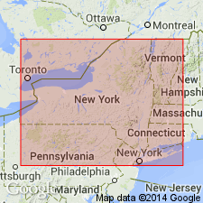
- Appalachian basin
Summary:
Pg. 544, 548. Berne member of Marcellus shale. Berne member is proposed for interval between Onondaga limestone and Otsego member of Marcellus in region east of Schoharie. Dark gray shale with a white or gray streak, and usually crumbles into small lumps; conchoidal fracture when fresh. It is = Union Springs, Cherry Valley, and Chittenango members of the Marcellus of Unadilla and Chenango Valleys and other areas. Age is Middle Devonian. 4
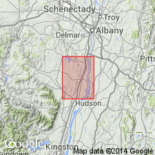
Type section in hill south of Berne, in Berne-Durham quadrangle, eastern NY, where member is 280 feet thick. [Named from town of Berne, Albany Co., eastern NY.]
Source: US geologic names lexicon (USGS Bull. 896, p. 170); supplemental information from GNU records (USGS DDS-6; Reston GNULEX).
- Usage in publication:
-
- Berne member
- Modifications:
-
- Areal extent
- AAPG geologic province:
-
- Appalachian basin
Summary:
Pg. 249. Discovery of Cherry Valley equivalent [=Stony Hollow member of Marcellus formation] in eastern New York affects nomenclature of strata of eastern Schoharie and Albany Counties. Berne member was proposed by Cooper for shale between Onondaga and MERISTELLA-coral bed of lower Otsego member [of Marcellus]. Name Berne thus designed to cover gray sandy equivalents of Union Springs, Cherry Valley and Chittenango members. Now that Cherry Valley equivalent has been recognized the name Bern must be restricted wholly to the Chittenango sandy shale equivalent about 100 to 150 feet thick. The Bakoven shale of Chadwick now represents the gray shale facies of the Union Springs. As thus restricted the Berne extends from its type locality around the northeast end of the Catskills at least as far south as Mount Marion and Halihan Hill north of Kingston. At these 2 places a coral bed about 140 feet above the Stony Hollow represents the MERISTELLA-coral zone. Unfortunately for mapping these are the only 2 places yet discovered where the MERISTELLA-coral zone appears in the eastern Catskill region. Undoubtably other localities will be discovered in future work. Until then the Berne member of the eastern Catskill region should be mapped with the Mount Marion.
Source: Publication.
- Usage in publication:
-
- Berne Member
- Modifications:
-
- Revised
- AAPG geologic province:
-
- Appalachian basin
Summary:
Mount Marion Formation of Hamilton Group is divided into Berne and overlying Otsego Members. The boundary between the two members is revised in this report. The base of the Otsego is placed at the base of a coral-brachiopod biostrome, the lowest rugose coral in a massive sandstone or the top of the massive sandstone (in the absence of corals). In the absence of both, the base is placed at the lowest shell-bed-rich shales that overlie an 8.0-m-thick package of thin sandstones and shales. The base is somewhat diachronous due to local erosive beveling. Formal names are proposed here for four key beds within the Formation: the Dave Elliott Bed occurs in the upper part of the Berne Member, the Halihan Hill Bed defines the base of the Otsego, and the Katsbaan and Timmerman Hill Beds occur in the lower part of the Otsego. The Dave Elliott is a fossiliferous sandstone up to 1.5 m thick lying 13 to 15 m below the top of the Berne. The Berne Member overlies the Stony Hollow Member of the Marcellus Formation and is Middle Devonian in age.
Source: GNU records (USGS DDS-6; Reston GNULEX).
For more information, please contact Nancy Stamm, Geologic Names Committee Secretary.
Asterisk (*) indicates published by U.S. Geological Survey authors.
"No current usage" (†) implies that a name has been abandoned or has fallen into disuse. Former usage and, if known, replacement name given in parentheses ( ).
Slash (/) indicates name conflicts with nomenclatural guidelines (CSN, 1933; ACSN, 1961, 1970; NACSN, 1983, 2005, 2021). May be explained within brackets ([ ]).