The National Geologic Map Database is migrating to a new infrastructure. We apologize for any service disruptions during this process.
|
|---|


- Usage in publication:
-
- Bernal formation*
- Modifications:
-
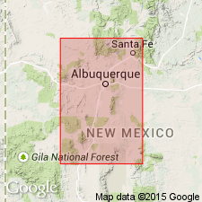
- Areal extent
- AAPG geologic province:
-
- Estancia basin
- Orogrande basin
Summary:
Fig. 2. Bernal formation. Name appears on composite stratigraphic chart of formations in Socorro and Santa Fe Counties, central northern New Mexico. Age is Permian.
Source: US geologic names lexicon (USGS Bull. 1200, p. 312-313).
- Usage in publication:
-
- Bernal formation*
- Modifications:
-
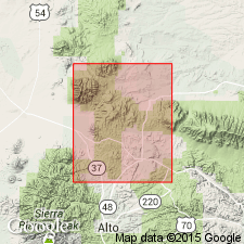
- Areal extent
- AAPG geologic province:
-
- Orogrande basin
Summary:
[In Capitan quadrangle, Lincoln County, New Mexico] is red quartz sandstone and shale 354 feet thick. Overlies upper Permian San Andres limestone. Age is Triassic(?).
Source: US geologic names lexicon (USGS Bull. 1200, p. 312-313).
- Usage in publication:
-
- Bernal formation*
- Modifications:
-
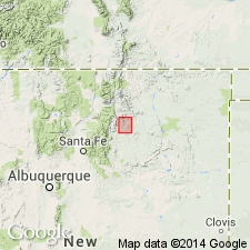
- Principal reference
- Dominant lithology:
-
- Siltstone
- Sandstone
- AAPG geologic province:
-
- Las Vegas-Raton basin
- Palo Duro basin
Summary:
Bernal formation. As defined herein, consists of brownish-red siltstone and fine-grained sandstone; in southern part of area, a single bed of gray to brown medium-grained sandstone about 1 foot thick is interbedded with the reddish-brown rocks. Average thickness 100 feet; 126 feet about 1 mile east of Ocate. Overlies Glorietta sandstone member of San Andres formation; disconformably underlies Santa Rosa sandstone. Has been considered a part of San Andres. Appears to be correlative with parts of Chalk Bluff formation of southeastern New Mexico and possibly Whitehorse sandstone of Oklahoma. Age is Permian.
Type sequence: near villages of Bernal and Chapelle, San Miguel Co., central northern NM.
[Replaced with Artesia Group (D.B. Tait and others, 1962, AAPG Bull., v. 46, no. 4).]
Source: US geologic names lexicon (USGS Bull. 1200, p. 312-313).
- Usage in publication:
-
- Bernal Formation
- Modifications:
-
- Not used
Summary:
Is an appropriate term for northeast and east-central NM that is equivalent to the lower half of the newly named Artesia Group. Term Bernal Formation not used in northeast and east central NM; name replaced by Artesia Group undifferentiated. Correlation chart shows Artesia as thinning toward east central? New Mexico and as equivalent to all of the Artesia in northeast New Mexico and to only the lower part of the Artesia in east central NM.
Source: GNU records (USGS DDS-6; Denver GNULEX).
- Usage in publication:
-
- Bernal Formation*
- Modifications:
-
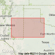
- Areal extent
- AAPG geologic province:
-
- Estancia basin
Summary:
Stratigraphic units included in interval C are the San Andres Limestone and the Artesia Formation (or Artesia Group where divisible). West of the Pedernal Hills, Torrance Co., NM in the Estancia basin, rocks of interval C of this report were called Bernal Formation in earlier reports. The Bernal is not present much farther west than the west boundary of Torrance and Santa Fe (also Estancia basin) Cos. East of this boundary, strata that were assigned to the Bernal have been renamed Artesia. Bernal shown on table 1, col. 12, USGS Map I-450, --which accompanies this professional paper --central NM west of Pedernal Hills as = to Grayburg and Queen Formations of the lower part of Artesia Group and of early Guadalupian age. [The usage in this report restricts Bernal to a limited area of Torrance and Santa Fe Cos., and restricts it from the area of its "type sequence" in San Miguel Co., a practice not recommended by the North American Stratigraphic Code (1983)].
Source: GNU records (USGS DDS-6; Denver GNULEX).
- Usage in publication:
-
- Bernal Formation
- Modifications:
-
- Not used
Summary:
[Term Bernal Formation was "not used" by Tait and others, 1969 when they established the Artesia group, though they did imply equivalence of Bernal to the lower part of the Artesia.] Term Bernal, thought by this author, as useful for "a thin northern facies that represents only part of the Artesia Group"; [term Bernal Formation is neither "assigned to the Artesia" as a formation, nor is it "abandoned" by this author.] Geologic map of the Pecos Valley area between 32 degrees and 34 degrees N Lat, and 104 degrees and 105 degrees W Long, Eddy and Chaves Cos, NM, Permian basin shows the (ascending): Grayburg, Queen, Seven Rivers, Yates, and Tansill Formations as individual mapped units. [Bernal obviously does not extend as far south as area shown on geologic map.]
Source: GNU records (USGS DDS-6; Denver GNULEX).
- Usage in publication:
-
- Bernal Formation†
- Modifications:
-
- Abandoned
- Dominant lithology:
-
- Siltstone
Summary:
Term has be misapplied in many areas of north-central NM to rocks that belong to the Middle Triassic Moenkopi Formation. History of Bernal usage described. Type section designated, measured, described on west end, Bernal Butte, SE1/4 NW1/4 SE1/4 sec. 36, T14N, R15E, San Miguel Co., NM, Las Vegas-Raton in order to demonstrate how to separate Bernal from Moenkopi. At the newly designated type, Bernal: unconformably overlies San Andres Formation; unconformably underlies Anton Chico Member of Moenkopi; is 42.5 m thick. Consists of red brown and red orange siltstone with massive gypsum 10 m above base and dolomitic limestone 2.3 m thick near top. The siltstone is sandy --quartzose with minor feldspar, mica, anhydrite and calcareous. The sand is very fine grained, subangular to subround, moderately to well sorted. Of clastic shelf origin related to transgressions and regressions of Permian sea. Finer grained than and distinguishable from the Moenkopi. Map shows northwest extent of type Bernal at Montezuma Gap, Rowe-Glorieta Mesa, and Lany. Bernal as previously recognized at Ocate, La Cueva, Hagan-Placitas, and San Ysidro-Red Mesa is Moenkopi. Is equivalent to Grayburg and Queen Formations, and possibly Seven Rivers Formation of Artesia Group; name has been misapplied to rocks of the Moenkopi. Recommend abandonment and replacement with name Artesia Formation.
Source: GNU records (USGS DDS-6; Denver GNULEX).
For more information, please contact Nancy Stamm, Geologic Names Committee Secretary.
Asterisk (*) indicates published by U.S. Geological Survey authors.
"No current usage" (†) implies that a name has been abandoned or has fallen into disuse. Former usage and, if known, replacement name given in parentheses ( ).
Slash (/) indicates name conflicts with nomenclatural guidelines (CSN, 1933; ACSN, 1961, 1970; NACSN, 1983, 2005, 2021). May be explained within brackets ([ ]).