The National Geologic Map Database is migrating to a new infrastructure. We apologize for any service disruptions during this process.
|
|---|


- Usage in publication:
-
- Bergstrom Formation
- Modifications:
-
- Original reference
- Dominant lithology:
-
- Claystone
- AAPG geologic province:
-
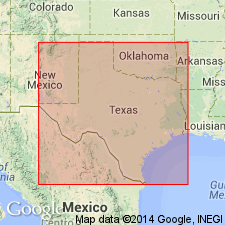
- Ouachita folded belt
Summary:
Pg. 4-6. Bergstrom Formation. Name proposed for claystone unit usually referred to as "Upper Taylor Marl." A greenish-gray to brownish-gray, unctuous, montmorillonitic claystone, more calcareous toward base, where it is transitional with underlying Pecan Gap Formation. Thickness about 400 feet. Underlies Corsicana Formation. [Fossils. EXOGYRA PONDEROSA is most characteristic megafossil; other fossil mollusks listed.] Age is Late Cretaceous.
Type locality: roadcuts along Farm Road 973, east of Moore and Berry's Crossing (mistakenly shortened to Moore's Crossing on TX Hwy. Dept. Travis Co. Hwy. map and USGS Montopolis quadrangle, topographic) of Onion Creek, just east of Bergstrom Field, Travis Co., central TX.
Source: US geologic names lexicon (USGS Bull. 1350, p. 60-61); supplemental information from GNU records (USGS DDS-6; Denver GNULEX).
For more information, please contact Nancy Stamm, Geologic Names Committee Secretary.
Asterisk (*) indicates published by U.S. Geological Survey authors.
"No current usage" (†) implies that a name has been abandoned or has fallen into disuse. Former usage and, if known, replacement name given in parentheses ( ).
Slash (/) indicates name conflicts with nomenclatural guidelines (CSN, 1933; ACSN, 1961, 1970; NACSN, 1983, 2005, 2021). May be explained within brackets ([ ]).