- Usage in publication:
-
- Berger formation*
- Modifications:
-
- Original reference
- Dominant lithology:
-
- Clay
- Sand
- Lignite
- AAPG geologic province:
-
- Ouachita folded belt
Summary:
Pg. 11 (fig. 4), 38-46, pls. Berger formation of Wilcox group. Proposed to include all terrestrial rocks between unconformity at top of marine sediments of Midway group and unconformity at base of Saline formation (new). Comprises section of gray and greenish-gray silty clay and argillaceous sand and some interbedded lignite and sideritic layers; where formation abuts nepheline syenite masses, it includes many bauxite deposits of Arkansas region and associated kaolinitic fragmental underclay. Contains three distinct facies: deposits of bauxite, bauxitic clay, and kaolinitic clay; deposits of lignite, lignitic clay, and gray silty clay that overlies bauxite deposits in many open-pit mines; deposits of gray "salt and pepper" or grayish-green sand that occupy channels in lignitic beds in overburden sections at several bauxite pits, that underlie lignite beds locally in several of the drilled areas, and that form major part of formation downslope from bauxite area. Thickness 0 to 347 feet; surface outcrops reach maximum of 25 feet; drill-hole data show greater thicknesses. Rests upon eroded surface of Wills Point formation; along lower slopes of nepheline syenite hills, generally overlaps Wills Point and rests on residual clay or on rocks of Paleozoic age; in larger subsurface valleys where Wells Point has been removed, Berger rests upon the Kincaid or upon basement rocks. Age is Eocene.
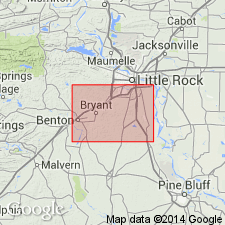
Type section: south side of Chicago, Rock Island, and Pacific RR tracks on east side of viaduct and road crossing tracks at Brittain siding, Pulaski Co., central AR, in SE/4 SW/4 sec. 5, T. 1 S., R. 12 W., 0.75 mi southwest of Berger. Exposed in a narrow discontinuous band of outcrop as much as 1.5 mi wide. Outcrop area extends northeastward from Hurricane Creek in Saline Co. to northeast end of Fourche Mountain in Pulaski Co. West of Hurricane Creek, wedges out beneath Saline formation. At east end of outcrop area, truncated by Quaternary sediments of Arkansas River flood plain.
Source: US geologic names lexicon (USGS Bull. 1200, p. 308-309).
For more information, please contact Nancy Stamm, Geologic Names Committee Secretary.
Asterisk (*) indicates published by U.S. Geological Survey authors.
"No current usage" (†) implies that a name has been abandoned or has fallen into disuse. Former usage and, if known, replacement name given in parentheses ( ).
Slash (/) indicates name conflicts with nomenclatural guidelines (CSN, 1933; ACSN, 1961, 1970; NACSN, 1983, 2005, 2021). May be explained within brackets ([ ]).

