The National Geologic Map Database is migrating to a new infrastructure. We apologize for any service disruptions during this process.
|
|---|


- Usage in publication:
-
- Benton Falls limestone
- Modifications:
-
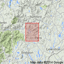
- Areal extent
- AAPG geologic province:
-
- New England province
Summary:
Pg. 22, 25. Benton Falls limestone [author does not capitalize rank terms; however, units are considered formal]. Interbedded limestone and shale, and marble. May have possible correlation with Berry Ledge formation (new). Name credited to Osberg (in prep.). Age is Silurian.
Type area: Waterville area, Kennebec Co., western ME.
Source: US geologic names lexicon (USGS Bull. 1350, p. 60).
For more information, please contact Nancy Stamm, Geologic Names Committee Secretary.
Asterisk (*) indicates published by U.S. Geological Survey authors.
"No current usage" (†) implies that a name has been abandoned or has fallen into disuse. Former usage and, if known, replacement name given in parentheses ( ).
Slash (/) indicates name conflicts with nomenclatural guidelines (CSN, 1933; ACSN, 1961, 1970; NACSN, 1983, 2005, 2021). May be explained within brackets ([ ]).