

- Usage in publication:
-
- Benson limestone
- Modifications:
-
- Original reference
- Dominant lithology:
-
- Limestone
- AAPG geologic province:
-
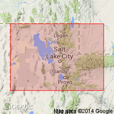
- Wasatch uplift
Summary:
Dec. 12, 1913; Pg. 109, 113. Benson limestone. Descending: (1) hard, dark-blue, cherty, coralline limestone, 100 feet; (2) massive dark-blue limestone, 300 feet; (3) fossiliferous blue limestone, 3 feet; (4) thick-bedded blue limestone, 100 feet; (5) dark-blue cherty and brecciated limestone, 200 feet; (6) hard blue limestone, 100 feet; (7) dark porous limestone, very fossiliferous, 21 feet; (8) thick-bedded blue limestone, extensively bored, 120 feet; (9) thick-bedded light-blue limestone, 43 feet; (10) thin-bedded blue limestone, 46 feet; (11) limestone conglomerate at base, thin. Total thickness 1,032 feet. Underlies Reade formation without observed disconformity. Unconformably overlies Maxfleld formation (Ordovician).
Named from occurrence in Reade [Reed] and Benson Ridge, just above old mine workings of same name, Salt Lake Co., UT.
Source: US geologic names lexicon (USGS Bull. 1200, p. 163).

- Usage in publication:
-
- Benson limestone
- Modifications:
-
- Biostratigraphic dating
- AAPG geologic province:
-
- Wasatch uplift
Summary:
Benson limestone. Fossils collected from lower 500 feet of these rocks (by B.S. Butler in 1916 and 1917) have been identified by G.H. Girty as clearly of Madison ([Early] Mississippian) age. Whether upper 900 feet contains evidence indicating that any part of formation is post-Madison, and of Brazer age, remains to be determined, but probably some of it is of Brazer ([Late] Mississippian) age. [Girty informal USGS paleontological report dated March 2, 1917.]
Source: US geologic names lexicon (USGS Bull. 896, p. 163).
For more information, please contact Nancy Stamm, Geologic Names Committee Secretary.
Asterisk (*) indicates published by U.S. Geological Survey authors.
"No current usage" (†) implies that a name has been abandoned or has fallen into disuse. Former usage and, if known, replacement name given in parentheses ( ).
Slash (/) indicates name conflicts with nomenclatural guidelines (CSN, 1933; ACSN, 1961, 1970; NACSN, 1983, 2005, 2021). May be explained within brackets ([ ]).