- Usage in publication:
-
- Bennington limestone*
- Modifications:
-
- Original reference
- Dominant lithology:
-
- Limestone
- AAPG geologic province:
-
- Ouachita folded belt
Summary:
Pg. 6. Bennington limestone. Massive dull-blue shell limestone, 10 to 15 feet thick, underlying Silo sandstone and overlying Bokchito formation. In Texas is represented by 80 to 100 feet of calcareous fossiliferous clays. Age is Early Cretaceous.
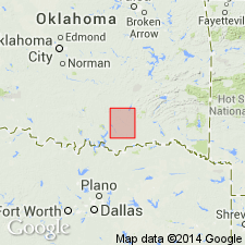
[Named from town of Bennington, in T. 6 S., R. 12 E., southeastern corner Atoka 1:125,000-scale quadrangle, Bryan Co., central southern OK.]
Source: Publication; US geologic names lexicon (USGS Bull. 896, p. 162).

- Usage in publication:
-
- Bennington Limestone
- Modifications:
-
- Mapped 1:250k
- Dominant lithology:
-
- Limestone
- AAPG geologic province:
-
- Ouachita folded belt
Summary:
Pamphlet [p. 4]. Bennington Limestone. Bluish-gray to yellowish-brown, fine- to medium-grained, crystalline, massive, fossiliferous with ILYMATOGYRA ARIETINA (Roemer), weathers pitted and honeycombed. Thickness 7 to 13 feet. Age is Early Cretaceous.
[Notable exposures in northeastern corner of map sheet, east of Caddo Creek, Bryan Co., southeastern OK, where it underlies Dexter Member of Woodbine Formation and overlies Pawpaw Sandstone Member of Bokchito Formation. West of Caddo Creek the Bennington and Grayson Marl are mapped undifferentiated.]
Source: Publication.
For more information, please contact Nancy Stamm, Geologic Names Committee Secretary.
Asterisk (*) indicates published by U.S. Geological Survey authors.
"No current usage" (†) implies that a name has been abandoned or has fallen into disuse. Former usage and, if known, replacement name given in parentheses ( ).
Slash (/) indicates name conflicts with nomenclatural guidelines (CSN, 1933; ACSN, 1961, 1970; NACSN, 1983, 2005, 2021). May be explained within brackets ([ ]).

