- Usage in publication:
-
- Bennett shale bed
- Modifications:
-
- Original reference
- Dominant lithology:
-
- Shale
- AAPG geologic province:
-
- Salina basin
Summary:
Pg. 84, 86, 88, 185. Bennett shale bed of Elmdale shale member of Wabaunsee formation. Bluish-gray and nearly black argillaceous shale with one carbonaceous streak resembling coal and a thin yellowish to brownish limestone. Thickness 8 to 10 feet in southeastern Nebraska and 12 feet in northeastern Kansas. Underlies Howe limestone and overlies Glenrock limestone; all included in Elmdale shale member of Wabaunsee formation. Age is Late Pennsylvanian (Missouri age). Report includes cross sections, measured sections, geologic maps, stratigraphic tables.
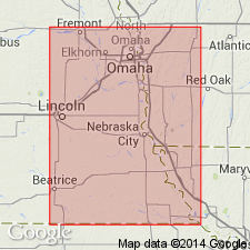
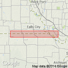
Named from exposures along the Little Nemaha River and its branches south of Bennett, Lancaster Co., southeastern NE.
Source: US geologic names lexicon (USGS Bull. 896, p. 162); GNC KS-NE Pennsylvanian Corr. Chart, sheet 1, Oct. 1936; supplemental information from GNU records (USGS DDS-6; Denver GNULEX).

- Usage in publication:
-
- Bennett shale member
- Modifications:
-
- Revised
- AAPG geologic province:
-
- Forest City basin
Summary:
Pg. 8. Bennett shale member of Red Eagle limestone formation of Council Grove group. Gray above, black below, quite fossiliferous. Thickness 5 to 7 feet. Underlies Howe limestone member and overlies Glenrock limestone member, both of Red Eagle. Age is considered Permian (lower part of Big Blue).
Red Eagle extended into southeastern Nebraska and northwestern Missouri; replaces Elmdale.
Source: Publication; US geologic names lexicon (USGS Bull. 896, Howe entry p. 987, Red Eagle entry p. 1784); GNC KS-NE Pennsylvanian Corr. Chart, sheet 2, Oct. 1936.

- Usage in publication:
-
- Bennett shale
- Modifications:
-
- Age modified
Summary:
Bennett shale member of Red Eagle limestone of Council Grove group. Transferred this unit to Permian (Big Blue series). This change in Permian-Pennsylvanian boundary has not been considered by the USGS for its publications [ca. 1938].
Source: US geologic names lexicon (USGS Bull. 896, p. 162); GNC KS-NE Pennsylvanian Corr. Chart, sheet 2, Oct. 1936.

- Usage in publication:
-
- Bennett shale
- Modifications:
-
- Overview
- AAPG geologic province:
-
- Salina basin
Summary:
E.C. Reed (Asst. State Geol. Nebraska), 1936 (letter dated Oct. 16). Type locality of Bennett shale is along the Little Nemaha and its branches south of Bennett, Lancaster County, southeastern Nebraska.
Source: US geologic names lexicon (USGS Bull. 896, p. 162).

- Usage in publication:
-
- Bennett shale member
- Modifications:
-
- Overview
- AAPG geologic province:
-
- Cherokee basin
Summary:
Pg. 48. Bennett shale member. As currently defined, consists of shale and, locally, some impure limestone; shale is characteristically dark-gray to black in lower part and light-gray in upper part; fossils (brachiopods) abundant locally in black shale; grades into limestone southward from Elk County, Kansas. Thickness 2.5 to 15 feet. Underlies Howe limestone member; overlies Glenrock limestone member. Age is Early Permian (Wolfcamp).
Source: US geologic names lexicon (USGS Bull. 1200, p. 301).

- Usage in publication:
-
- Bennett Shale Member
- Modifications:
-
- Overview
Summary:
(Paleozoic Era; Permian System by H.G. O'Connor, D.E. Zeller, C.K. Bayne, J.M Jewett, and Ada Swineford, p. 46.) Bennett Shale Member of Red Eagle Limestone of Council Grove Group. North of Wabaunsee County, Kansas, is chiefly gray to very dark-gray, calcareous shale containing ORBICULOIDEA. From southern Wabaunsee County to southern Greenwood County contains an increasing amount of limestone. South of Greenwood County, chiefly light-gray limestone in which brachiopods, echinoderms, corals, and algae are common (citing H.G. O'Connor and J.M. Jewett, 1952, Kansas Geol. Survey Bull. 96, pt. 8, p. 329-362). Thickness 4 to 27 feet. Occurs above Glenrock Limestone Member and below Howe Limestone Member, both of Red Eagle Limestone. Age is Early Permian; Gearyan Provincial Stage (of H.G. O'Connor, 1963, AAPG Bull., v. 47, p. 1873-1877).
Source: Publication.
For more information, please contact Nancy Stamm, Geologic Names Committee Secretary.
Asterisk (*) indicates published by U.S. Geological Survey authors.
"No current usage" (†) implies that a name has been abandoned or has fallen into disuse. Former usage and, if known, replacement name given in parentheses ( ).
Slash (/) indicates name conflicts with nomenclatural guidelines (CSN, 1933; ACSN, 1961, 1970; NACSN, 1983, 2005, 2021). May be explained within brackets ([ ]).

