- Usage in publication:
-
- Bend formation
- Modifications:
-
- Age modified
- AAPG geologic province:
-
- Klamath Mountains province
Summary:
Pg. 27. Bend formation, consisting of slates and argillaceous limestone, embraces, as far as is known, the Early and Middle Jurassic.
Source: US geologic names lexicon (USGS Bull. 896, p. 381).

- Usage in publication:
-
- Bend formation
- Modifications:
-
- Age modified
- AAPG geologic province:
-
- Klamath Mountains province
Summary:
Pg. 611. Bend formation was named by J.S. Diller (prelim. proof-edition of USGS Lassen Peak folio, 1892) to include all Jurassic deposits of region of Big Bend of Pitt [Pit] River. In a later publication Mr. Diller (GSA Bull., v. 4, 1893, p. 221) stated that Pitt [Pit] River Jura corresponds to Mormon sandstone (Middle Jura) of Taylorsville region. About 6 miles west of Big Bend, in Big Canyon, H.W. Fairbanks [1893] discovered fossils, in shaly limestones, which, on examination by writer, proved to be Jurassic and probably = Hardgrave sandstone (Lower Jura) of Indian Valley.
Source: US geologic names lexicon (USGS Bull. 896, p. 381).

- Usage in publication:
-
- Bend formation*
- Modifications:
-
- Principal reference
- Dominant lithology:
-
- Slate
- Sandstone
- Conglomerate
- Limestone
- AAPG geologic province:
-
- Klamath Mountains province
Summary:
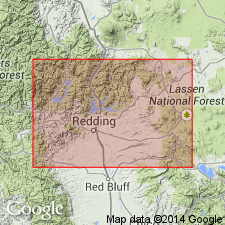
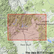
(and 1892 prelim. proof-sheet ed. of USGS Lassen Peak folio). The Bend formation contains some limestone, but is composed chiefly of slates, sandstones, and conglomerates, and crops out along western arm of Great Bend of Pit River, Gold Belt region [Shasta County], northern California. Isolated areas of the limestone are exposed near stage road 1 mile west of Montgomery Creek, and the slates and sandstones form upper part of north slope of Cedar Creek 4 miles west of Round Mountain. Jurassic fossils. Rests on Cedar formation and is overlain by Chico formation.
Source: US geologic names lexicon (USGS Bull. 896, p. 381); supplemental information from GNU records (USGS DDS-6; Menlo GNULEX).

- Usage in publication:
-
- Bend formation†
- Modifications:
-
- Abandoned
- AAPG geologic province:
-
- Klamath Mountains province
Summary:
†Bend formation abandoned. Includes Potem and Modin formations.
Source: US geologic names lexicon (USGS Bull. 896, p. 381).

- Usage in publication:
-
- Bend formation†
- Modifications:
-
- Abandoned
- AAPG geologic province:
-
- Klamath Mountains province
Summary:
Pg. 976. "The term 'Bend formation' was applied to the Jurassic sequence in the Lassen quadrangle (Diller, 1895, p. 4) but was later abandoned, because of prior usage, in favor of Potem formation."
Source: US geologic names lexicon (USGS Bull. 1200, p. 298); GNU records (USGS DDS-6; Menlo GNULEX).
For more information, please contact Nancy Stamm, Geologic Names Committee Secretary.
Asterisk (*) indicates published by U.S. Geological Survey authors.
"No current usage" (†) implies that a name has been abandoned or has fallen into disuse. Former usage and, if known, replacement name given in parentheses ( ).
Slash (/) indicates name conflicts with nomenclatural guidelines (CSN, 1933; ACSN, 1961, 1970; NACSN, 1983, 2005, 2021). May be explained within brackets ([ ]).

