The National Geologic Map Database is migrating to a new infrastructure. We apologize for any service disruptions during this process.
|
|---|


- Usage in publication:
-
- Belmont diorite porphyry dikes and sheets
- Belmont porphyry*
- Modifications:
-
- Original reference
- Dominant lithology:
-
- Porphyry
- AAPG geologic province:
-
- Montana folded belt
Summary:
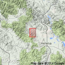
Belmont diorite porphyry dikes and sheets. Later than Marysville batholith. [Mapped on and around Mount Belmont, 1 mile west of Marysville, Marysville district, central western Montana. The Marysville batholith is probably late Cretaceous or Tertiary, and may be as young as Miocene. Personal communication of J.T. Pardee.]
[Belmont porphyry adopted by the USGS.]
Source: US geologic names lexicon (USGS Bull. 896, p. 156).
For more information, please contact Nancy Stamm, Geologic Names Committee Secretary.
Asterisk (*) indicates published by U.S. Geological Survey authors.
"No current usage" (†) implies that a name has been abandoned or has fallen into disuse. Former usage and, if known, replacement name given in parentheses ( ).
Slash (/) indicates name conflicts with nomenclatural guidelines (CSN, 1933; ACSN, 1961, 1970; NACSN, 1983, 2005, 2021). May be explained within brackets ([ ]).