The National Geologic Map Database is migrating to a new infrastructure. We apologize for any service disruptions during this process.
|
|---|


- Usage in publication:
-
- Belleview Member*
- Modifications:
-
- Adopted
- Mapped 1:24k
- Dominant lithology:
-
- Claystone
- Sandstone
- AAPG geologic province:
-
- Coastal basins
Summary:
Belleview Member of Pismo Formation of Hall, 1973a (California Div. Mines Geol. Map Sheet, no. 24) is adopted. Conformably overlies and underlies Gragg and Squire Members of Pismo, respectively. Marine. Age is late Pliocene.
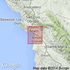
[Notable exposures along San Miguelito fault zone in southern part of study area, Port San Luis 7.5-min quadrangle, San Luis Obispo Co., southern CA.]
Source: Changes in stratigraphic nomenclature, 1967 (USGS Bull. 1405-A, p. A2-A3); GNU records (USGS DDS-6; Menlo GNULEX).
- Usage in publication:
-
- Belleview Member
- Modifications:
-
- Original reference
- Biostratigraphic dating
- Dominant lithology:
-
- Claystone
- Sandstone
- Siltstone
- AAPG geologic province:
-
- Coastal basins
Summary:
Belleview Member of Pismo Formation. Previously called informal Bellevue member by Hall and Sardum (1967). Consists mostly of light-gray bedded resistant medium-grained sandstone (60 percent quartz) and siltstone [map unit b2]. Basal part [b1], interbedded buff fine-grained sandstone and claystone; claystone is spheroidally fractured, sandy beds are locally fossiliferous. Upper part includes well-bedded resistant diatomaceous siltstone and claystone or silty dolomite beds [2d]. Total thickness 650 feet. Conformably underlies Squire Member and overlies Gragg Member; both of Pismo Formation. Carries marine megafossils; ANADARA TRILINEATA (Conrad), CRYPTOMYA CALIFORNICA (Conrad), ACILA (TRUNCACILA) CASTRENSIS (Hinds), CARDITA (CYCLOCARDIA) CALIFORNICA (Dall), LUCINOMA ANNULATA (Reeve), NUCULANA cf. N. (SACCELLA) CELLULITA (Dall), NATICA(?) sp. Age is late Pliocene, based on fossils.
Type locality: along access road to U.S. Highway 101 near site of the old Belleview school, about 500 ft northeast of the hamlet of Miles, in T. 31 S., R. 12 E., Pismo Beach 7.5-min quadrangle, San Luis Obispo Co., southern CA. Named from the old Belleview school.
[Typographical error (US geologic names lexicon, USGS Bull. 1520, p. 25): strat. section on geol. map indicates a conformable contact btw. the Belleview and Squire Members, not unconformable.]
Source: Publication; US geologic names lexicon (USGS Bull. 1520, p. 25); GNU records (USGS DDS-6; Menlo GNULEX).
For more information, please contact Nancy Stamm, Geologic Names Committee Secretary.
Asterisk (*) indicates published by U.S. Geological Survey authors.
"No current usage" (†) implies that a name has been abandoned or has fallen into disuse. Former usage and, if known, replacement name given in parentheses ( ).
Slash (/) indicates name conflicts with nomenclatural guidelines (CSN, 1933; ACSN, 1961, 1970; NACSN, 1983, 2005, 2021). May be explained within brackets ([ ]).