

- Usage in publication:
-
- Bell Springs Member*
- Modifications:
-
- Named
- Dominant lithology:
-
- Sandstone
- AAPG geologic province:
-
- Green River basin
Summary:
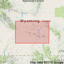
Named as basal member of Nugget Sandstone for Bell Springs, Carbon Co, WY in Greater Green River basin. Type section is about 1 1/2 mi northwest of Bell Springs in NW1/4 SE1/4 sec 9, T23N, R88W. Extends into Wind River basin. Is 210 ft thick at type. Thins to about 210 ft thick at Rawlins. Is about 240 ft thick at Ferris Mountains (sec 18, T27N, R88W). Pinches out east of Sips Creek, Carbon Co. Grades transitionally into upper part of Nugget. Overlies Popo Agie Formation (rank raised) of Chugwater Group (rank raised) disconformably. Composed of very fine grained limy sandstone that is distinguished from upper part of Nugget by presence of red to purple-red shale and lime cemented siltstone in beds less than 0.1 ft thick and by presence of calcareous firmly indurated beds 1-4 ft thick that are ripple laminated and weather to square faced ledges. May correlate with upper part of Chinle Formation. Assigned a Triassic? age. Cross sections.
Source: GNU records (USGS DDS-6; Denver GNULEX).
For more information, please contact Nancy Stamm, Geologic Names Committee Secretary.
Asterisk (*) indicates published by U.S. Geological Survey authors.
"No current usage" (†) implies that a name has been abandoned or has fallen into disuse. Former usage and, if known, replacement name given in parentheses ( ).
Slash (/) indicates name conflicts with nomenclatural guidelines (CSN, 1933; ACSN, 1961, 1970; NACSN, 1983, 2005, 2021). May be explained within brackets ([ ]).