

- Usage in publication:
-
- Belhaven Phosphatic Sand Member*
- Modifications:
-
- Named
- Dominant lithology:
-
- Sand
- Clay
- Limestone
- Dolomite
- AAPG geologic province:
-
- Atlantic Coast basin
Summary:
Advance copy (1978). Belhaven Phosphatic Sand Member of Pungo River Formation. Consists of medium greenish-brown phosphatic sand with gray-green clay and limestone and dolomite beds. Thickness at type 58 feet (18 m). Unconformably overlies the Castle Hayne Formation; conformably underlies the Bonnerton Member of Pungo River. Age is early and middle Miocene.
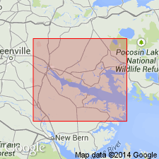
Type section (subsurface): depth-interval 152 to 210 ft (46 to 64 m), corehole AU-1-GRL, near Aurora, Aurora 7.5-min quadrangle, Beaufort Co., NC. Named from town of Bonnerton, Beaufort Co., NC (Albemarle embayment).
Source: Modified from GNU records (USGS DDS-6; Reston GNULEX).
For more information, please contact Nancy Stamm, Geologic Names Committee Secretary.
Asterisk (*) indicates published by U.S. Geological Survey authors.
"No current usage" (†) implies that a name has been abandoned or has fallen into disuse. Former usage and, if known, replacement name given in parentheses ( ).
Slash (/) indicates name conflicts with nomenclatural guidelines (CSN, 1933; ACSN, 1961, 1970; NACSN, 1983, 2005, 2021). May be explained within brackets ([ ]).