The National Geologic Map Database is migrating to a new infrastructure. We apologize for any service disruptions during this process.
|
|---|


- Usage in publication:
-
- Belfry Member
- Modifications:
-
- Named
- Dominant lithology:
-
- Sandstone
- Siltstone
- Shale
- Lignite
- Limestone
- Marl
- AAPG geologic province:
-
- Bighorn basin
Summary:
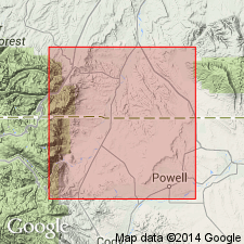
Named as formal member of Fort Union Formation (an informal term of Hickey, 1980). Type section designated in Cody Road 2.5 km south of town of Belfry on state highway 397, sec 27, T18S [T8S], R22E, Carbon Co, MT, Bighorn basin. Occurs in Hollenbeck Draw 7 1/2 min quad to south. Of limited areal extent. Has distinctive easily recognizable outcrop characteristics. Consists of an fining upward cycle of: 1) fine-grained sandstone, tabular and trough crossbeds; 2) fine-grained parallel-bedded sandstone with siltstone interbeds; 3) parallel-bedded siltstone or shale; 4) lignite and gray mudstone and carbonaceous shale, 5) argillaceous and fossiliferous limestone and marl. Total thickness as much as 600 m. Two types of freshwater limestones: 1) tabular, resistant ledge-former with abundant fossils; 2) fine-grained carbonate muds containing randomly dispersed silt grains and localized concentrations of sand-sized detritus. Sandstones are dominantly fine grained, poorly sorted and feldspathic. Petrologic and mineralogic descriptions. Upper and lower contacts not described. Hickey (1980) assigned a Tiffanian age (middle to late Paleocene) based on megafloral and pollen fossils collected [but not described in this report] from lacustrine and adjacent facies. Deposited in shallow lakes or in a chain of lakes. Climate during deposition was humid and temperate. Source areas in Beartooth and Bighorn Mountains.
Source: GNU records (USGS DDS-6; Denver GNULEX).
For more information, please contact Nancy Stamm, Geologic Names Committee Secretary.
Asterisk (*) indicates published by U.S. Geological Survey authors.
"No current usage" (†) implies that a name has been abandoned or has fallen into disuse. Former usage and, if known, replacement name given in parentheses ( ).
Slash (/) indicates name conflicts with nomenclatural guidelines (CSN, 1933; ACSN, 1961, 1970; NACSN, 1983, 2005, 2021). May be explained within brackets ([ ]).