

- Usage in publication:
-
- Belden shale member
- Modifications:
-
- Original reference
- Dominant lithology:
-
- Shale
- Limestone
- Sandstone
- Coal
- AAPG geologic province:
-
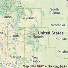
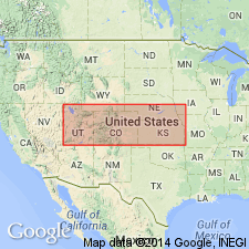
- Eagle basin
Summary:
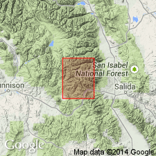
Pg. 1376 (fig. 1), 1383-1384, 1385-1387. Belden shale member of Battle Mountain formation. Proposed as member of Battle Mountain formation to replace name Weber shale in area. Composed of 100 to 200 feet of black and dark-gray carbonaceous shale and argillaceous limestone with thin beds of dark-colored sandstone; thin seams of impure coal present locally. Thickness at type locality about 125 feet. Underlies Robinson limestone member; unconformably overlies Leadville limestone. Age is Pennsylvanian.
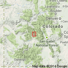
Type section: north side of Rock Creek Valley along U.S. Highway 24 (1938) 0.2 mi north of Gilman, Eagle Co., northwestern CO. Named from station of Belden on Denver and Rio Grande Western RR.
Source: US geologic names lexicon (USGS Bull. 1200, p. 281).
- Usage in publication:
-
- Belden shale*
- Modifications:
-
- Revised
- AAPG geologic province:
-
- Piceance basin
- Eagle basin
- Las Vegas-Raton basin
Summary:
Pg. 624-627. Belden shale. Rank raised to formation. Replaces Weber shale as applied to basal Pennsylvanian in Colorado, and is Des Moines in age. Base is clearly defined erosional contact with the pre-Pennsylvanian; gradationally underlies Maroon formation.
Source: US geologic names lexicons (USGS Bull. 1200, p. 281, Maroon entry, p. 2389-2391).
- Usage in publication:
-
- Belden formation
- Modifications:
-
- Biostratigraphic dating
- AAPG geologic province:
-
- Green River basin
Summary:
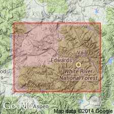
Pg. 23 (fig. 1), 42-43, 67+ (measured sections). Belden formaiton. Limestone with some shale, sandstone, claystone, and conglomerate; highly fossiliferous. Contains abundant algae, brachiopods, corals, bryozoans, crinoid fragments, and fusulinid foraminifers; trilobites and pelecypods are less common. Fusulinid fauna are of the genus MILLERELLA, notably M. ADVENA Thompson, M. INFLECTA, n. sp., M. CIRCULI, n.sp., M. cf. M. PRESSA Thompson, M. aff. M. MARBLENSIS Thompson, and M. sp. Form A. Species are closely similar to forms from Kearny formation of Kansas, Bloyd shale of the type Morrowan of Arkansas, and Wapanucka limestone of Oklahoma. Age is considered Early Pennsylvanian (Morrowan), probably closely similar in age to Morrowan limestone of extreme western Texas. Underlies Hells Canyon formation or Youghall formation; overlies Mississippian rocks.
Sections measured and described from northwestern CO, and across state line into northeastern UT, along Sweetwater Creek, Eagle Co., northwestern CO (p. 23, fig. 2), Sheep Mountain Canyon, Daggett Co., northeastern UT (p. 26, fig. 3), and Split Mountain and Juniper Mountain Canyons, Moffat County, northwestern CO (p. 27, figs. 4, 5), White River uplift and Uinta Mountains areas.
Source: Publication.
- Usage in publication:
-
- Belden shale*
- Modifications:
-
- Areal extent
- AAPG geologic province:
-
- Eagle basin
Summary:
Pg. 152 (table 1), 192-193. Belden shale. Described in Pando area. Following usage of Brill (1944), term Belden shale is applied to dark Pennsylvanian shales and limestones unconformably overlying Leadville dolomite --the beds formerly called Weber(?) shale. Thickness 25 to 200 feet. Underlies Minturn formation (new). Grades upward into overlying Minturn formation. Age is Pennsylvanian.
Source: US geologic names lexicon (USGS Bull. 1200, p. 281).
- Usage in publication:
-
- Belden shale
- Modifications:
-
- Areal extent
- AAPG geologic province:
-
- Piceance basin
Summary:
Pg. 552 (fig. 3), 556, 557, 559-561. Belden shale. Described in Crested Butte
quadrangle, Gunnison County, northwestern Colorado, where it is 451 to 555 feet thick, and underlies Gothic formation (new). [Age is Pennsylvanian.]
Source: US geologic names lexicon (USGS Bull. 1200, p. 281).
- Usage in publication:
-
- Belden shale*
- Modifications:
-
- Areal extent
- AAPG geologic province:
-
- Eagle basin
- Piceance basin
Summary:
Pg. 16-17. Belden shale. Discussed in Garfield quadrangle, Chaffee and Gunnison Counties, [northwestern Colorado]. Maximum thickness about 1,110 feet. At most places, three units can be distinguished: lower, 200 to 500 feet, chiefly dark shale or argillite; middle, 400 to 700 feet, limestone and shale in which either one or the other may predominate; upper, about 200 feet, contains more quartzite than underlying beds. Grades into overlying Minturn; contact arbitrarily placed where quartzite and micaceous shales of Minturn exceed limestone and shale of Belden. Overlies Leadville; locally overlies Manitou. In Monarch and Tomichi districts, Crawford (1913) used term Garfield formation for lower 2,600 feet of Pennsylvanian section. In present usage, Belden shale corresponds to lower 1, 110 feet of Crawford's Garfield formation. [Age is Pennsylvanian.]
Source: US geologic names lexicon (USGS Bull. 1200, p. 281).
- Usage in publication:
-
- Belden Shale*
- Modifications:
-
- Areal extent
- AAPG geologic province:
-
- Piceance basin
Summary:
Thin tongue of Pennsylvanian Belden Shale recognized in subsurface of Moffat Co, CO, Piceance basin. Overlies Molas Shale (rather than Molas Formation) and underlies Morgan Formation. [Nearby on outcrop in eastern Uinta Mountains, CO the pre-Weber Sandstone Pennsylvanian sequence consists of Round Valley Limestone and overlying Morgan Formation.]
Source: GNU records (USGS DDS-6; Denver GNULEX).
For more information, please contact Nancy Stamm, Geologic Names Committee Secretary.
Asterisk (*) indicates published by U.S. Geological Survey authors.
"No current usage" (†) implies that a name has been abandoned or has fallen into disuse. Former usage and, if known, replacement name given in parentheses ( ).
Slash (/) indicates name conflicts with nomenclatural guidelines (CSN, 1933; ACSN, 1961, 1970; NACSN, 1983, 2005, 2021). May be explained within brackets ([ ]).