- Usage in publication:
-
- Belchertwon Intrusive Complex
- Modifications:
-
- Revised
- Dominant lithology:
-
- Quartz diorite
- Granodiorite
- AAPG geologic province:
-
- New England province
Robinson, Peter, 1967, Progress report on bedrock geologic mapping in west-central Massachusetts: University of Massachusetts, Conference on Economic Geology in Massachusetts Proceedings, p. 29-47.
Summary:
Pg. 33, 34. Belchertwon Intrusive Complex. Consists of massive biotite and (or) hornblende quartz diorite, biotite-hornblende-diopside granodiorite, marginal zones and inclusions of hornblendite and diopside hornblendite. Evidence indicates emplacement before end of deformation associated with metamorphism. Development of coarse sillimanite in an included septum of Partridge Formation in a regional kyanite zone indicates major thermal effect of intrusion. Younger than Prescott Intrusive Complex (new). Age is Devonian(?).
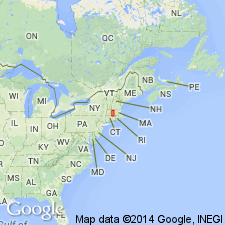
Present in Bronson Hill anticline, [west-central Massachusetts], a complex zone of gneiss domes and recumbent folds, that lies near center of Appalachian tectonic belt of New England. Generalized axis of anticline in Massachusetts runs 3 to 5 miles east of Triassic border fault. Anticline consists of an en echelon series of gneiss domes interrupted by the cross-cutting Belchertown Intrusive Complex.
Source: US geologic names lexicon (USGS Bull. 1350, p. 56).

- Usage in publication:
-
- Belchertown Complex*
- Modifications:
-
- Overview
- AAPG geologic province:
-
- New England province
Summary:
Used as Belchertown Complex. Intrudes Lower Devonian Erving Formation. Subdivided into 10 unnamed but lithologically distinct units. Age is Devonian.
Source: GNU records (USGS DDS-6; Reston GNULEX).

- Usage in publication:
-
- Belchertown Complex*
- Modifications:
-
- Revised
- AAPG geologic province:
-
- New England province
Summary:
Belchertown Intrusive Complex of Robinson (1967) revised to Belchertown Complex. Includes quartz monzodiorite, quartz monzodiorite gneiss, pyroxenite, hornblendite, intrusive breccia, tonalite, and dacite porphyry. Age is Devonian.
Source: GNU records (USGS DDS-6; Reston GNULEX).
For more information, please contact Nancy Stamm, Geologic Names Committee Secretary.
Asterisk (*) indicates published by U.S. Geological Survey authors.
"No current usage" (†) implies that a name has been abandoned or has fallen into disuse. Former usage and, if known, replacement name given in parentheses ( ).
Slash (/) indicates name conflicts with nomenclatural guidelines (CSN, 1933; ACSN, 1961, 1970; NACSN, 1983, 2005, 2021). May be explained within brackets ([ ]).

