

- Usage in publication:
-
- Beecher Island shale member
- Modifications:
-
- Original reference
- Dominant lithology:
-
- Shale
- Bentonite
- AAPG geologic province:
-
- Denver basin
- Las Animas arch
Summary:
Beecher Island shale member of Pierre shale. Chiefly light-gray shale with distinct greenish tint on many outcrops; thin streaks of white and brownish bentonite occur in lower part of the shale, where also limestone concretions (the largest 1 foot thick) are common; irregular-shaped and comparatively small limestone bodies with LUCINA constitute uppermost concretionary zone, above which occur 5 to 10 feet more of shale with rusty limonite streaks. Thickness of member 100+/- feet. Is top member of Pierre shale in Yuma County, Colorado. Lies 500 to 600 feet higher than Salt Grass shale member of Pierre. [Separated from underlying Salt Grass shale member of Pierre by 500 to 600 feet of undifferentiated shale which was not studied by author.] Underlies Ogallala formation. Recognized in Yuma County, northeastern Colorado and Cheyenne County, northwestern Kansas. Age is Late Cretaceous. Report includes stratigraphic table, correlation chart, generalized section, measured sections, fossil list.
Named from exposures at Beecher Island, Yuma Co., northeastern CO.
Source: US geologic names lexicon (USGS Bull. 896, p. 144); supplemental information from GNU records (USGS DDS-6; Denver GNULEX).

- Usage in publication:
-
- Beecher Island shale member
- Modifications:
-
- Overview
- AAPG geologic province:
-
- Chadron arch
Summary:
Pg. 22, 23 (fig. 11). Beecher Island shale member of Pierre shale of Montana group. Gray shale; irregular concretionary limestone near top; limonite concretions throughout; thin beds of bentonite and limestone concretions in lower part. Thickness 100 feet. Uppermost member of Pierre shale; overlies an unnamed shale member, 500 to 600 feet thick, that in turn overlies Salt Grass shale member. Age is Late Cretaceous (Gulfian).
Source: US geologic names lexicon (USGS Bull. 1200, p. 271-272).
- Usage in publication:
-
- Beecher Island Member*
- Modifications:
-
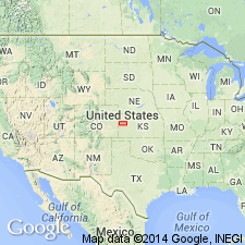
- Areal extent
- AAPG geologic province:
-
- Las Animas arch
- Denver basin
Summary:
Beecher Island Member, uppermost member of Pierre Shale in western Kansas and eastern Colorado. Exposures along the Arikaree River, near town of Beecher Island in southeastern Yuma County, Colorado [type exposures], and in Cheyenne County, Kansas [at locality Cragin (1896) applied name "Arikaree shales"]. Consists of 100 feet of light-gray shale that, being transitional between clay shale of Pierre and sandy beds of overlying Fox Hills, is somewhat silty or sandy. Lower part of member contains gray, fossiliferous, silty limestone concretions that weather yellowish-gray; upper part of member contains thin layers of limonite, rusty-weathering limestone, and concretions having cone-in-cone structure. Age is Late Cretaceous. Contains BACULITES GRANDIS Hall and Meek in lower part; B. CLINOLOBATUS Elias in upper part, in addition to TENUIPTERIA FIBROSA (Meek and Hayden) and species of DISCOSCAPHITES and HOPLOSCAPHITES.
[GNU remark (June 23, 1987, USGS DDS-6; Denver GNULEX): Beecher Island is not listed on the stratigraphic chart in this report.]
Source: Modified from GNU records (USGS DDS-6; Denver GNULEX).
For more information, please contact Nancy Stamm, Geologic Names Committee Secretary.
Asterisk (*) indicates published by U.S. Geological Survey authors.
"No current usage" (†) implies that a name has been abandoned or has fallen into disuse. Former usage and, if known, replacement name given in parentheses ( ).
Slash (/) indicates name conflicts with nomenclatural guidelines (CSN, 1933; ACSN, 1961, 1970; NACSN, 1983, 2005, 2021). May be explained within brackets ([ ]).