The National Geologic Map Database is migrating to a new infrastructure. We apologize for any service disruptions during this process.
|
|---|


- Usage in publication:
-
- Bedford Canyon formation*
- Modifications:
-
- Original reference
- Dominant lithology:
-
- Slate
- Argillite
- AAPG geologic province:
-
- Peninsular Ranges province
Summary:
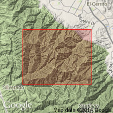
Pg. 18-22, pl. 1. Bedford Canyon formation. Name proposed for group of mildly metamorphosed slates and argillites with some quartzites and a few thin lenses of limestone. Thickness unknown because base is not exposed and top is a surface of erosion; probably 20,000 feet exposed in Santa Ana Mountains. Unconformably underlies Santiago Peak volcanics (new). [Intruded by granitic rocks.] Smith (1898) used term Santa Ana for a limestone in these slates in western part of Santa Ana Mountains. Merrill (1914) called the slates the Santa Ana metamorphic strata. Since Santa Ana has been used for Tertiary strata in California, name Bedford Canyon is used here. [Age is Triassic, based on fossils (Smith, 1898).]
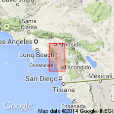
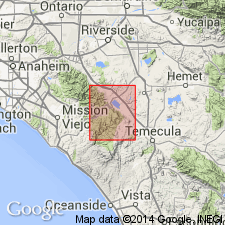
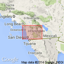
Named from Bedford Canyon, [Riverside Co.], southern CA, where formation is well exposed. Formation lies west of main batholith (of southern California) and underlies much of Santa Ana Mountains. Regional strike of formation is about N. 30 deg. W., approx. parallel to Santa Ana Mountains and the coast. Region dip is to the east; averages about 50 deg. in Santa Ana Mountains and a little steeper to the east.
[Misprint (US geologic names lexicon, USGS Bull. 1200, p. 268): Bedford Canyon is in Riverside Co., not Orange Co.]
Source: US geologic names lexicon (USGS Bull. 1200, p. 267-268); supplemental information from GNU records (USGS DDS-6; Menlo GNULEX).
- Usage in publication:
-
- Bedford Canyon formation*
- Modifications:
-
- Geochronologic dating
- AAPG geologic province:
-
- Peninsular Ranges province
Summary:
Intruded by batholithic rocks of early Late Cretaceous age.
Source: GNU records (USGS DDS-6; Menlo GNULEX).
- Usage in publication:
-
- Bedford Canyon formation*
- Modifications:
-
- Mapped
- AAPG geologic province:
-
- Peninsular Ranges province
Summary:
Report mapped Bedford Canyon Formation as "Santa Ana Formation" in Lake Elsinore 15' quad, Santa Ana Mtns., CA.
Source: GNU records (USGS DDS-6; Menlo GNULEX).
- Usage in publication:
-
- Bedford Canyon formation*
- Modifications:
-
- Age modified
- Biostratigraphic dating
- AAPG geologic province:
-
- Peninsular Ranges province
Summary:
Assigned "pre-middle Cretaceous" age to metamorphic and slightly to unmetamorphosed terrane which included Bedford Canyon or Santa Ana Formation, Santiago Peak Volcanics and Alisitos Formation. Fossils in "Bedford Canyon" range from Triassic to Late Jurassic (Cliff Grey, personal communication).
Source: GNU records (USGS DDS-6; Menlo GNULEX).
- Usage in publication:
-
- Bedford Canyon formation*
- Modifications:
-
- Mapped
- AAPG geologic province:
-
- Peninsular Ranges province
Summary:
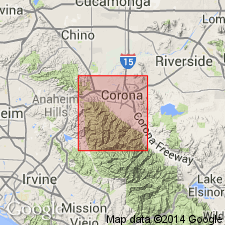
Mapped in Corona South 7.5-min quadrangle, Riverside and Orange Counties, California.
Source: GNU records (USGS DDS-6; Menlo GNULEX).
- Usage in publication:
-
- Bedford Canyon formation*
- Modifications:
-
- Age modified
- Biostratigraphic dating
- AAPG geologic province:
-
- Peninsular Ranges province
Summary:
Is assigned Late Jurassic(?) (Portlandian) age based on bivalves and belemnites (Imlay, 1959) collected in Penasquitos Canyon area from questionable Bedford Canyon Formation rocks.
Source: GNU records (USGS DDS-6; Menlo GNULEX).
- Usage in publication:
-
- Bedford Canyon formation*
- Modifications:
-
- Age modified
- Biostratigraphic dating
- AAPG geologic province:
-
- Peninsular Ranges province
Summary:
Part of unit is assigned Late Jurassic age based on ammonites collected in Ladd Canyon area (Imlay, written communication, 1960) and based on brachiopods collected on the ridge SE of Bedford Canyon (Ager, written communication, 1961).
Source: GNU records (USGS DDS-6; Menlo GNULEX).
- Usage in publication:
-
- Bedford Canyon formation*
- Modifications:
-
- Age modified
- Biostratigraphic dating
- AAPG geologic province:
-
- Peninsular Ranges province
Summary:
Part of unit is assigned Middle Jurassic (Callovian) age based on ammonites, collected at Ladd Canyon, Santa Ana Mtns., but Triassic(?) age is also a strong possibility based on brachiopods (Larsen, 1948).
Source: GNU records (USGS DDS-6; Menlo GNULEX).
- Usage in publication:
-
- Bedford Canyon formation*
- Modifications:
-
- Mapped
- AAPG geologic province:
-
- Peninsular Ranges province
Summary:
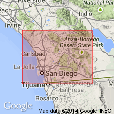
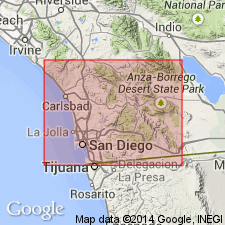
Julian Schist and Bedford Canyon Formations are mapped "undivided" but map states that Bedford Canyon is in northwest part of San Diego Co.
Source: GNU records (USGS DDS-6; Menlo GNULEX).
- Usage in publication:
-
- Bedford Canyon formation*
- Modifications:
-
- Age modified
- Biostratigraphic dating
- AAPG geologic province:
-
- Peninsular Ranges province
Summary:
Part of unit is assigned a Middle Jurassic (Bajocian) age based on pelecypods collected near head of McBride Canyon, Santa Ana Mtns., CA.
Source: GNU records (USGS DDS-6; Menlo GNULEX).
- Usage in publication:
-
- Bedford Canyon formation*
- Modifications:
-
- Areal extent
- AAPG geologic province:
-
- Peninsular Ranges province
Summary:
Extended into and mapped in Winchester area, Riverside Co., CA. Conformably overlies French Valley Formation (new) in area.
Source: GNU records (USGS DDS-6; Menlo GNULEX).
- Usage in publication:
-
- Bedford Canyon Formation*
- AAPG geologic province:
-
- Peninsular Ranges province
Summary:
French Valley Formation may overlie Bedford Canyon Formation.
Source: GNU records (USGS DDS-6; Menlo GNULEX).
- Usage in publication:
-
- Bedford Canyon Formation*
- Modifications:
-
- Age modified
- AAPG geologic province:
-
- Peninsular Ranges province
Summary:
Is lithologically similar to and maybe southern extension of Franciscan Complex. Age here is extended to Early Cretaceous(?) based on stratigraphic relations.
Source: GNU records (USGS DDS-6; Menlo GNULEX).
- Usage in publication:
-
- Bedford Canyon Formation*
- Modifications:
-
- Age modified
- Geochronologic dating
- AAPG geologic province:
-
- Peninsular Ranges province
Summary:
May be separated into Permo-Triassic (228+/-4.3 Ma) and Middle Jurassic (175.8+/-3.2 Ma) informal members based on Rb/Sr ages for fine-grained sediments.
Source: GNU records (USGS DDS-6; Menlo GNULEX).

- Usage in publication:
-
- Bedford Canyon Formation*
- Modifications:
-
- Age modified
- Biostratigraphic dating
- AAPG geologic province:
-
- Peninsular Ranges province
Summary:
Assigned Middle Jurassic age (Bajocian, Bathonian, and Callovian) based on fossils now dated Middle Jurassic but formerly considered Triassic.
Source: GNU records (USGS DDS-6; Menlo GNULEX).
- Usage in publication:
-
- Bedford Canyon Formation*
- Modifications:
-
- Mapped
- AAPG geologic province:
-
- Peninsular Ranges province
Summary:
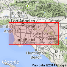
Mapped in Orange Co., CA. Assigned Jurassic age.
Source: GNU records (USGS DDS-6; Menlo GNULEX).
- Usage in publication:
-
- Bedford Canyon Formation*
- Modifications:
-
- Mapped
- AAPG geologic province:
-
- Peninsular Ranges province
Summary:
Mapped in Black Star Canyon and part of El Toro quads. May be 5500 m thick in Silverado Canyon. Assigned Middle Jurassic age based on earlier reports.
Source: GNU records (USGS DDS-6; Menlo GNULEX).
For more information, please contact Nancy Stamm, Geologic Names Committee Secretary.
Asterisk (*) indicates published by U.S. Geological Survey authors.
"No current usage" (†) implies that a name has been abandoned or has fallen into disuse. Former usage and, if known, replacement name given in parentheses ( ).
Slash (/) indicates name conflicts with nomenclatural guidelines (CSN, 1933; ACSN, 1961, 1970; NACSN, 1983, 2005, 2021). May be explained within brackets ([ ]).