The National Geologic Map Database is migrating to a new infrastructure. We apologize for any service disruptions during this process.
|
|---|


- Usage in publication:
-
- Bechler conglomerate*
- Modifications:
-
- Original reference
- Dominant lithology:
-
- Sandstone
- Conglomerate
- AAPG geologic province:
-
- Snake River basin
Summary:
Pg. 76, 82. Bechler conglomerate of Gannett group. Gray, reddish, and "salt and pepper" sandstones with interbedded conglomerates. Pebbles of conglomerate are small, few having diameter of more than 1 inch. Thickness 1,776 feet. Underlies Draney limestone and overlies Peterson limestone; all in Gannett group. May be Jurassic. [ca. 1936, age is considered Cretaceous(?).]
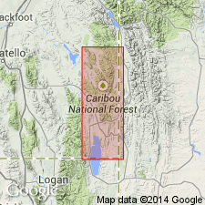
Named from Bechler Creek, which enters Stump Creek from north about 0.25 mi. north of mouth of Boulder Creek, in T. 6 S., R. 45 E., Boise meridian, Bannock Co., southeastern ID.
Source: US geologic names lexicon (USGS Bull. 896, p. 141).
- Usage in publication:
-
- Bechler Formation
- Modifications:
-
- Overview
- Areal extent
- AAPG geologic province:
-
- Green River basin
- Wasatch uplift
- Snake River basin
Summary:
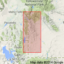
Is one of five formations in the Gannett Group. Overlies Peterson Limestone of the Gannett. Underlies Draney Limestone of Gannett. Cross sections. Isopach map; thickens westward from less than 200 ft thick in western Lincoln Co, WY (Greater Green River basin) to 1600+ ft thick in Caribou Co, ID (Wasatch uplift). Extends northward into Bonneville Co, ID (Snake River basin) and southward into Bear Lake Co, ID (Wasatch uplift). Exposures along Bechler Creek considered to be the type section where it consists of conglomerate, sandstone, and mudstone. Calcareous nodules present in mudstone. Measured section in Lincoln Co described where Bechler is 1,113.5 ft thick. Probably is an orogenic deposit. Microfossils found in nodular zones. Fossils (charophytes, ostracods) listed. Of Early Cretaceous, Aptian age.
Source: GNU records (USGS DDS-6; Denver GNULEX).
For more information, please contact Nancy Stamm, Geologic Names Committee Secretary.
Asterisk (*) indicates published by U.S. Geological Survey authors.
"No current usage" (†) implies that a name has been abandoned or has fallen into disuse. Former usage and, if known, replacement name given in parentheses ( ).
Slash (/) indicates name conflicts with nomenclatural guidelines (CSN, 1933; ACSN, 1961, 1970; NACSN, 1983, 2005, 2021). May be explained within brackets ([ ]).